[SatNews] A big project with a big product with, hopefully, big results, in Canada.
The Honorable James Moore, Minister of Industry, joined Canadian Space Agency (CSA) Astronaut David Saint-Jacques today at the Canada Aviation and Space Museum in Ottawa to unveil the Canada from Space Giant Floor Map.
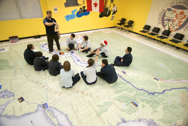
The Canada from Space maps and teaching tools will be available to schools across Canada to help students to better understand the important role space and Earth Observation satellites play in their daily lives.
The maps and teaching tools will also strengthen students’ geographical knowledge by locating on the map unique images of Canada taken by Canadian astronaut Chris Hadfield from the International Space Station.
This project is part of a collaboration between Canada’s Aviation and Space Museum (CASM), the Royal Canadian Geographical Society (RCGS) and the Canadian Space Agency.
This investment is aligned with the "Inspiring Canadians" principle of motivating young Canadians to pursue careers in science, technology, engineering and math, as outlined in Canada's Space Policy Framework.
- The Canada from Space map is part of the RCGS’ Giant Floor Map Program.
- There are five Canada from Space giant floor maps, measuring 11 by 8 metres and weighing 100 pounds, accompanied by fully bilingual classroom activities for use by teachers.
- The themes discussed in the classroom activities are linked to Earth Observation. They include: disaster management; pollution; water and oceans; ice monitoring; navigation; resource monitoring; and weather.
- Each of the maps is a mosaic of 121 images of Canada taken from space by Canada’s Radarsat-2 satellite.
- Circulation will begin as of September 2014, over a three-year period, until 2017. Through a collaboration with the CASM, the RCGS will be responsible for the bookings and circulation of these maps across Canada. Each map will visit roughly 14 schools per year, free of charge.
- The Canadian Government has invested $135,000 for the development of the maps, teacher’s kits, and activities for students. The Government will also cover the costs of circulating the maps to classrooms around the country.
“Thanks to the tremendous success of former International Space Station commander Chris Hadfield, and Canadian inventions like the Canadarm and Dextre, students all across this country know and understand many of Canada’s important contributions to exploring the cosmos. We’re pleased to unveil the Canada from Space map, giving Canadian students a chance to look back at our planet from space. I hope that it will inspire young Canadians to pursue careers in science, technology, engineering and math so that we can continue to learn, explore, and push the boundaries of human ingenuity,” said the Honorable James Moore, Minister of Industry.
Stephen Quick, Director General, Canada Aviation and Space Museum stated, “This is a really exciting collaborative project for the Canada Science and Technology Museums Corporation that both complements our work in engaging school children with their Science and Technology heritage and shows how the work of the CSA enriches the lives of all Canadians. By collaborating with the Royal Canadian Geographic Society and the CSA in creating these beautiful and innovative maps, we can provide students with a new and unique perspective on their world and their place in it.”
“Few Canadian students will ever travel in space but many will have the opportunity to view the country from space thanks to this unique educational resource. As a geographical society, our mission is to help chart Canada’s future. This innovative educational resource serves our mission and we are grateful to our partners, the Canada Aviation and Space Museum and the Canadian Space Agency, for their far-sightedness and their support,” said John Geiger, CEO of the Royal Canadian Geographical Society.
Royal Canadian Geographical Society’s Giant Floor Map Program

