
[SatNews] “Analysts may utilize this data to better understand where infrastructure is located, where the disease has the greatest risk of transmission, and what populations are most at risk.”
The National Geospatial-Intelligence Agency (NGA) recently released a series of Image City Map™ products, derived from DigitalGlobe satellite imagery and human geography data sets, which are playing a key role in the international effort to combat the Ebola crisis in western Africa.
“Analysts may utilize this data to better understand where infrastructure is located, where the disease has the greatest risk of transmission, and what populations are most at risk”
A broad coalition of governments and non-governmental organizations are leveraging this unclassified and sharable foundational geospatial intelligence to support response operations and anticipate emerging disease patterns.

“This proactive and forward-leaning government-industry partnership is crucial when it comes to preparing for and responding to humanitarian crises of all kinds,” said William Arras, DigitalGlobe’s Vice President of U.S. Government Customer Experience.
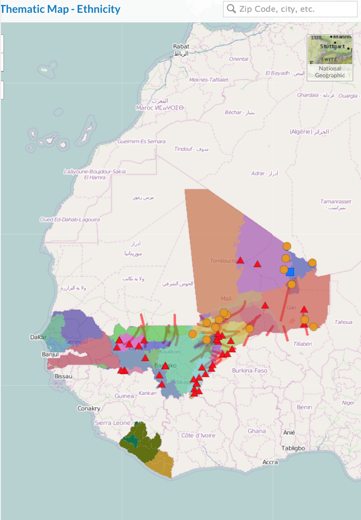
The satellite imagery is available via NGA’s EnhancedView program, which is helping military operators, civilian healthcare workers, international partner nations and volunteers understand events on the ground with daily new collections across the region. NGA has also released country-scale DigitalGlobe human geography data layers, including information on the region’s demographics, critical infrastructure, economies, ethnicities, education levels, environment, medical facilities, and significant events, all of which can inform relief efforts and operational planning.
“Analysts may utilize this data to better understand where infrastructure is located, where the disease has the greatest risk of transmission, and what populations are most at risk,” said Arras.
“Our partnership with DigitalGlobe to provide geospatial information and mapping products to the largest audience possible is crucial in supporting the international community and health care personnel in West Africa as they respond to the Ebola crisis,” said Martin Cox, National Geospatial-Intelligence Officer for Africa and Mission Manager for the Ebola GEOINT Response.