
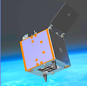
UK-DMC 2 is one of two enhanced DMC (Disaster Monitoring Constellation) Earth observation satellites, UK DMC-2 and Deimos 1, are capable of imaging several thousand km along track and delivering double the data density of the first generation DMC satellites, increasing the ground sample distance from 32 meters to 22 meters, while maintaining the very wide swath of 660 km.
UK-DMC2 SSTL

Seven years ago another satellite was launched and added to the foreboding named constellation, Disaster Monitoring Constellation (DMC) otherwise called the Earth observation satellite, UK-DMC2.
The DMC delivers valuable geospatial information for agriculture, forestry, land cover mapping, disaster monitoring and environmental sciences, coordinated and specialized in rapidly programmed campaigns. The ground sample distance was increased from 32 meters to a 22 meter resolution multispectral satellite imagery, and the option for very wide area monitoring, adjustable up to 620km swath.
In addition, because of the daily revisit capacity coupled with rapid data delivery, the DMC is able to deliver up-to-date imagery and rapid whole country coverage. This is a helpful tool for all applications requiring timely image collection.
As an example, in North Africa, prone to yearly plagues of locust, UK-DMC2 data is used by the Algerian Space Agency to assess vegetation conditions. When combined with weather data, locust forecasts can be created and used to focus the application of pesticides, which in turn can help prevent the spread of locust swarms.
Land cover mapping also takes benefit from DMC imagery. Because of their rapid revisit and wide swath imaging capabilities, annual and seasonal maps are easily available, providing a dataset for change detection analysis. Such land cover evolution maps are critical for applications including climate change, ecology and conservation, urban and landscape planning, along with health and hazard assessments.
Bernhard Brenner, Head of Intelligence Business Cluster at Airbus Defence and Space stated, “The Disaster Monitoring Constellation (DMC) has also been actively delivering data for the response and management of disaster events since 2004. UK-DMC2 has a bright future and will continue to support environmental and mapping needs into the foreseeable future.”
https://airbusdefenceandspace.com