

Together they'll deliver improved imagery to farmers, making their lives and livelihood better and more profitable.
Airbus Defence and Space will be working with the GIS mapping engine operator Satshot to provide high-resolution SPOT 6/7 satellite data over a large area of the corn and wheat belt within the continental United States. SPOT 6/7 data is integrated into the Satshot platform, which can be used for deep analysis of specific farmland for further improved operations and efficiency.
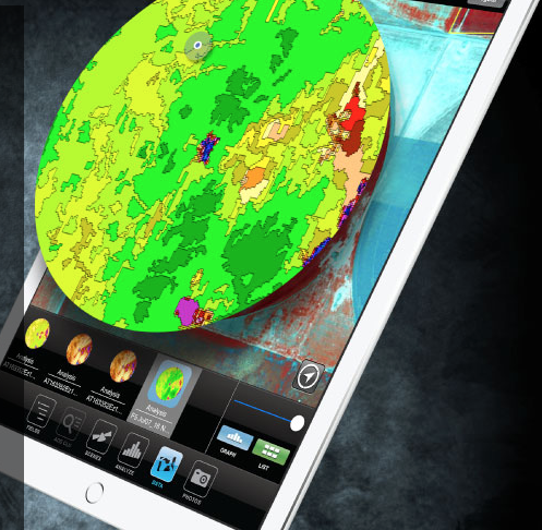
Satshot is a fully customized cloud-based online Geographic Information System (GIS) mapping engine that handles satellite imagery distribution, analysis, and management for the agricultural (ag) industry. Satshot relies on three main platforms (Mapcenter, Landscoutand iCue) along with various imagery to help growers be more efficient in the field. SPOT 6/7 data can be used within Satshot’splatforms for a variety of applications, such as: crop health monitoring and stress estimation throughout the season, Normalized Difference Vegetation Index (NDVI), crop damage assessment for insurance, land use sustainability management, land value, and Precison Ag Variable Rate Technologies (VRT).
SPOT 6/7 data provides 1.5 meter high resolution natural color and near infra-red information with daily collection opportunities making the data a valuable source for analysis and decision-making in the ag industry. The large swath and coverage capabilities of the twin satellites allow for mapping from a national level down to fragmented farmland parcels at a very competitive price point. This trade-off between resolution, coverage and revisit is key to monitor crop growth and needs more closely and make better informed decisions.
François Lombard, Head of the Intelligence Business at Airbus Defence and Space said they are thrilled to have a partner like Satshot, who is leveraging their SPOT 6/7 satellites to serve the US agriculture industry with high value information. He added that disseminating imagery and value added data into the hands of our partners will provide near real-time solutions for farmers, agribusinesses and will have a positive impact on food production and sustainability.
Lanny Faleide, President and founder of Satshot continued saying that this is the first time satellite imagery of this quality and resolution will be accessible to the ag market at exactly the scale needed and at an attractive price level. They are extremely excited to get this data in the hands of everyone in the ag industry to truly help create added insight and understanding concerning our clients' fields and managed crops.
Airbus Defence and Space and Satshot will expand this partnership to provide more imagery and data into the Satshot platforms.