

NOAA is touting the newest improvements in the upcoming launch this Saturday of GOES-R. Just to fill you in on what the improvements are is as follows.
Imagine going from a black and white TV to high definition overnight. GOES-R is faster and clearer than current GOES satellites, providing forecasters with more detail and more information than ever before.
Using a powerful new instrument, called the Advanced Baseline Imager, or ABI, GOES-R will provide data and imagery about weather over the entire Western Hemisphere in real-time—it can even do it as frequently as every 30 seconds! This enables NOAA to gather data using three times more channels, four times the resolution, at five times faster than before. This faster, more accurate data means better observations of developing storms. The ABI will be used for a wide range of applications related to weather, oceans, land, climate and hazards.
Japan’s Himawari-8 satellite uses a nearly identical imager to the one that will be aboard GOES-R. Located over the Asia-Pacific region, Himawari-8 provides geostationary Earth observations over the Eastern Hemisphere. This data, along with other geostationary satellites around the globe, help provide a more complete understanding of Earth from 22,000 miles away.
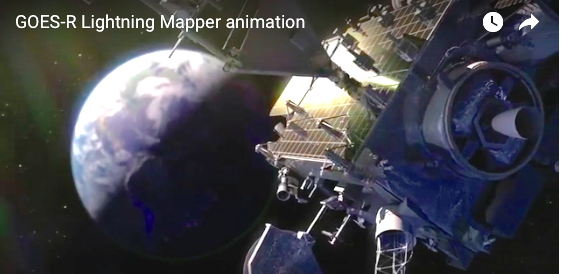
GOES-R's Revolutionary Lightning Mapper is the first operational lightning mapper ever flown in space. Based on years of research, the Geostationary Lightning Mapper, or GLM, is a revolutionary new instrument that will measure total lightning (in-cloud, cloud-to-cloud and cloud-to-ground) activity continuously over the Americas and adjacent ocean regions with near-uniform spatial resolution.
Severe weather often exhibits a significant increase in lightning activity many minutes before radar can detect a potential storm. This data visualization shows actual lightning measurements captured by an array of ground-based lightning detectors capable of tracing how lightning propagates through the atmosphere. It simulates how the GOES-R Geostationary Lightning Mapper will monitor atmospheric flashes in and around potentially severe weather. This technology could provide critical minutes of valuable warning time in advance of approaching severe storms.
GOES-R: Monitoring Space Weather will be a game changer for forecasting across the United States, but did you know Earth’s weather is not the only weather the satellite will monitor?
In today’s digital world, space weather is no joke. Geomagnetic storms, caused by eruptions on the surface of the sun, can interfere with communications and navigation systems on Earth, threaten power utilities, damage satellites, and cause risk to astronauts. GOES-R has a suite of instruments that play a critical role in monitoring space weather.
GOES-R: A helping hand for those who need it. GOES-R, the nation’s most advanced weather satellite to date, will not only provide more weather and environmental information than ever before, it will also provide a helping hand to stranded hikers, sailors, and pilots.
Equipped with a transponder that detects emergency distress signals emitted from emergency beacons, GOES-R will relay the location of activated beacons to NOAA, who will notify search and rescue personnel at the US Coast Guard or Air Force. Since SARSAT began in 1982, the program has aided in the rescue of nearly 40,000 people worldwide, including roughly 8,000 within the United States and its surrounding waters. In fact, on August 24, 2016, NOAA Satellites aided in the rescue of 45 people stranded at sea. It was the largest single rescue event in, or around, the United States credited to NOAA’s role in the international Search and Rescue Satellite Aided Tracking (SARSAT) system.
https://www.nesdis.noaa.gov/node/99