
[SatNews] The sediment stretched more than four miles down the mountain, and the slide was triggered on a near-vertical mountain face 9,200 feet high...
An enormous landslide near Mount La Perouse in southeastern Alaska has been captured in a pair of before-and-after photos by NASA, which can be viewed in the image below.
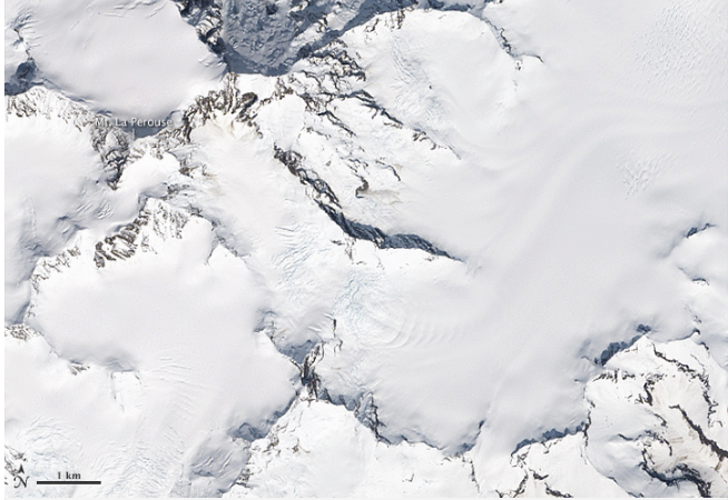
These images provided by NASA show a before-and-after look at the area affected by a Feb. 16 landslide in southeastern Alaska.
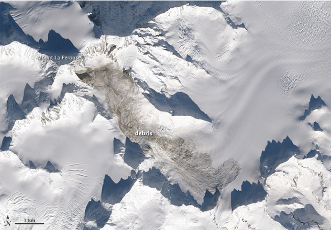
According to a NASA report, preliminary estimates suggest the landslide moved more than 68 million metric tons of material, which would make it the biggest landslide on Earth since 2010.
The sediment stretched more than four miles down the mountain, and the slide was triggered on a near-vertical mountain face 9,200 feet high, Columbia University seismologist Colin Stark told NASA's Earth Observatory.
Because earthquake monitors often can't detect landslides, Stark used the Global Centroid-Moment-Tensor Project to identify the waves produced by the slide and start looking for exactly where it occurred. The Global CMT tool narrowed the location down to a 10-square-mile area in southeastern Alaska, NASA reported, and a helicopter pilot spotted the landslide a few days later.
Landsat 8 passed over the affected area on February 23 to get the follow-up shot of the post-slide landscape from space.