
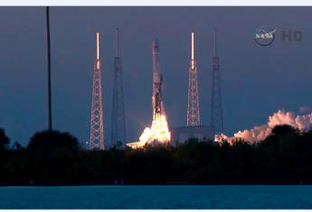
[SatNews] NOAA’s DSCOVR launched today aboard a SpaceX Falcon 9 rocket from Space Launch Complex 40 at Cape Canaveral Air Force Station in Florida. The spacecraft is fitted with several instruments, including two from NASA, that will measure conditions on Earth as part of the agency’s continuing work to evaluate the planet’s climate.
However, there are some issues... SpaceX is still tracking towards a 6:03pm ET liftoff of DSCOVR, but unfortunately we will not be able to attempt to recover the first stage of the Falcon 9. The drone ship was designed to operate in all but the most extreme weather. We are experiencing just such weather in the Atlantic with waves reaching up to three stories in height crashing over the decks. Also, only three of the drone ship’s four engines are functioning, making station-keeping in the face of such wave action extremely difficult. The rocket will still attempt a soft landing in the water through the storm (producing valuable landing data), but survival is highly unlikely.
DSCOVR is a partnership between NOAA, NASA and the U.S. Air Force and will maintain the nation’s solar wind observations capability. These observations are critical to the accuracy and lead time of NOAA’s space weather alerts, forecasts, warnings and space weather events like geomagnetic storms caused by changes in solar wind. Such events can affect public infrastructure systems including power grids, telecommunications systems and avionics aboard aircraft.
Originally known as Triana, named after Rodrigo de Triana, the first of Columbus's crew to sight land in the Americas, the satellite's original purpose was to provide a near-continuous view of the entire Earth and make that live image available via the Internet. In addition to an imaging camera, a radiometer would take the first direct measurements of how much sunlight is reflected and emitted from the whole Earth (albedo). The scientific goals expanded to measure the amount of solar energy reaching Earth, cloud patterns, weather systems, monitor the health of Earth's vegetation, and track the amount of UV light reaching the surface through the ozone layer.
DSCOVR succeeds NASA’s Advanced Composition Explorer in supporting solar observations and will provide 15 to 60 minute warning time to improve predictions of geomagnetic storm impact locations.
Triana was removed from its original launch opportunity on STS-107 (the ill-fated Columbia mission in 2003). The $100 million satellite remained in a storage facility, and in November 2008 the satellite was removed from storage and began recertification for a possible launch on board a Delta II or a Falcon 9.
In September 2013 NASA cleared DSCOVR to proceed to the implementation phase targeting of an early 2015 launch which had been announced in December 2012 would be launched on a SpaceX Falcon 9 rocket. NASA Goddard Space Flight Center is providing management and systems engineering to the mission.
The Deep Space Climate Observatory, or DSCOVR, will maintain the nation's real-time solar wind monitoring capabilities which are critical to the accuracy and lead time of NOAA's space weather alerts and forecasts. Without timely and accurate warnings, space weather events like the geomagnetic storms caused by changes in solar wind have the potential to disrupt nearly every major public infrastructure system, including power grids, telecommunications, aviation and GPS.
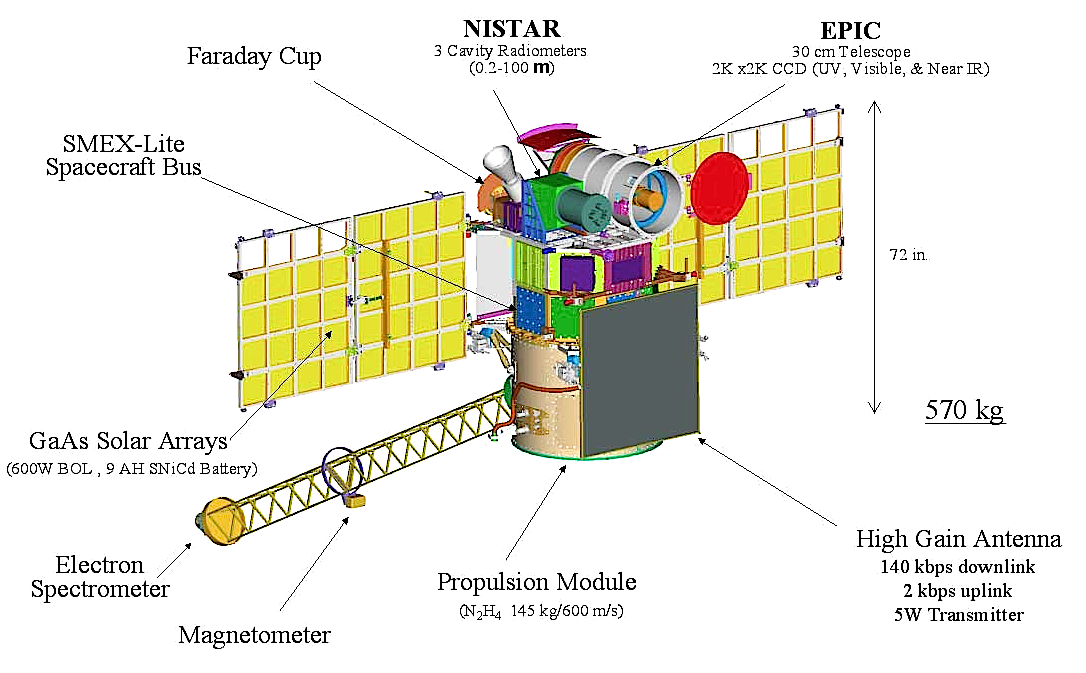
DSCOVR will succeed NASA's Advanced Composition Explore's (ACE) role in supporting solar wind alerts and warnings from the L1 orbit, the neutral gravity point between the Earth and sun approximately one million miles from Earth. L1 is a good position from which to monitor the sun, because the constant stream of particles from the sun (the solar wind) reaches L1 about an hour before reaching Earth.
From this position, as mentioned earlier, DSCOVR will typically be able to provide 15 to 60 minute warning time before the surge of particles and magnetic field, known as a coronal mass ejection (or CME), associated with a geomagnetic storm reaches Earth. DSCOVR data will also be used to improve predictions of geomagnetic storm impact locations. Our national security and economic well-being, which depend on advanced technologies, are at risk without these advanced warnings.
For more information about the DSCOVR mission, visit: http://www.nesdis.noaa.gov/DSCOVR