
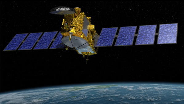
[Satnews] Jason-3, the latest in a series of satellites that tracks the rate of global sea-level rise and can help NOAA more accurately forecast the strength of tropical cyclones, is scheduled to launch later next month. The U.S.-European partnership mission will lift off aboard a SpaceX Falcon 9 rocket on January 17 at approximately 10:42 a.m. PST from Vandenberg Air Force Base in California.
Like its predecessor missions, Jason-3 will use a radar altimeter instrument and fly in a low-Earth orbit, allowing it to monitor 95 percent of Earth’s ice-free oceans every 10 days. Since the Topex/Poseidon-Jason missions began in 1992, global sea-level rise has occurred at about 3 mm a year, resulting in a total change of 70 mm (2.8 inches) in 23 years, according to researchers.
“The rate of sea-level rise is an important indicator of climate change happening around the world,” said Laury Miller, NOAA’s Jason-3 program scientist and chief of NOAA’s Laboratory for Satellite Altimetry. “We are already seeing significant impacts on coastal regions globally, including more frequent flooding events along the coastal United States.”
Like its predecessor missions, Jason-3 will use a radar altimeter instrument and fly in a low-Earth orbit, allowing it to monitor 95 percent of Earth’s ice-free oceans every 10 days. In addition to detecting climate change factors, Jason-3 data will help predict short-term, severe weather events, such as hurricanes and tropical storms.
In addition to detecting climate change factors, Jason-3 data will help predict short-term, severe weather events, such as hurricanes and tropical storms. NOAA will use the altimeter measurements to monitor ocean conditions that trigger changes in the strength of tropical cyclones, as they move over the ocean towards the land. The technique involves mapping the ocean heat content, the fuel that feeds a storm’s intensity, along a storm’s predicted track.
“The ocean heat content from satellite altimeters can reduce the error of NOAA’s hurricane intensity forecast models by as much as 20 percent in some instances,” Miller said.
Like its predecessor missions, Jason-3 will use a radar altimeter instrument and fly in a low-Earth orbit, allowing it to monitor 95 percent of Earth’s ice-free oceans every 10 days. In addition to detecting climate change factors, Jason-3 data will help predict short-term, severe weather events, such as hurricanes and tropical storms.
Measurements from Jason-3 will be used for other scientific, commercial and operational applications, including: mesoscale deep-ocean and wave modeling, surface wave forecasting for offshore operators; forecasting tides and currents for commercial shipping and ship routing; coastal forecasting for response to environmental problems, including oil spills and harmful algal blooms; coastal modeling, which is crucial for marine mammal and coral reef research and El Niño and La Niña forecasting.
“Data from Jason satellites have been invaluable to the study of El Nino and its impacts for the past two decades," said Josh Willis, NASA's Jason-3 project scientist. "With the launch of Jason-3, our efforts to better monitor and understand the widespread effects of El Nino around the world will continue for years to come."
Jason-3 is an international cooperative mission in which NOAA is partnering with NASA, CNES (the French Space Agency) and the European Organisation for the Exploitation of Meteorological Satellites, (or EUMETSAT). Jason-3 will eventually replace Jason-2, which was launched in 2008.