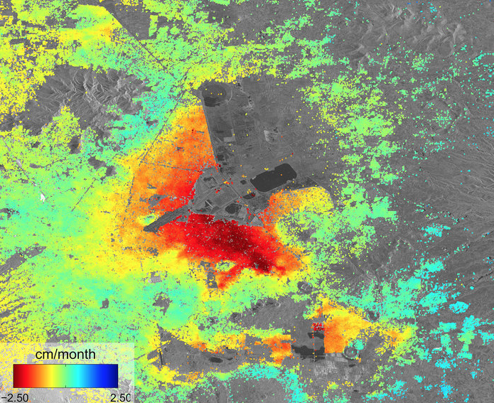
[SatNews] The parched Earth imaging photos of Mexico City reveal ground deformation when ground water is extracted, whether by drought or man.

ESA's Sentinel-1A radar scans acquired between October 3 and December 2, 2014.
Five Sentinel-1A radar scans were combined to create this image of ground deformation in Mexico City. The deformation is caused by ground water extraction, with some areas of the city subsiding at up to 2.5 cm/month (red).
This image was released 11/12/2014 2:00 pm. Mexico City was the subject of Mexico City subsidence
Five Sentinel-1A radar scans acquired between 3 October and 2 December 2014 These preliminary results were presented at the InSARap Workshop at ESA’s ESRIN center for Earth observation in December 2014. InSARap is a project under ESA’s Scientific Exploitation of Operational Missions (SEOM) program.
Copyright Copernicus data (2014)/ESA/DLR Microwave and Radar Institute–SEOM InSARap study.
Id 331155
USGS Findings

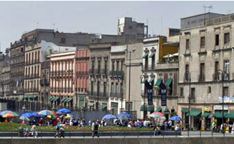
A row of buildings, showing effects of land subsidence, near the Great Temple in Mexico City. Credit: Chris Earle.
When you look at this picture of buildings in Mexico City these buildings seem to be following a wave pattern instead of a straight line from left to right.
In fact, that is just what is happening not only to these buildings, but throughout Mexico City, where long-term extraction of groundwater has caused significant land subsidence and associated aquifer-system compaction, which has damaged colonial-era buildings, buckled highways, and disrupted water supply and waste-water drainage. Some buildings have been deemed unsafe and have been closed and many others have needed repair to keep them intact.

