
[SatNews] ...become the first commercial entity to sell hyperspectral weather data to government and commercial enterprises.
Tempus Global Data, Inc. today announced the formation of a science advisory council, to provide guidance and insight into the successful design, build and launch of STORM, the highly anticipated hyperspectral sounding weather instrument.
Alan Hall, Chairman and CEO of Tempus Global Data, released the names of the team members in conjunction with the first meeting recently conducted in Washington D.C.
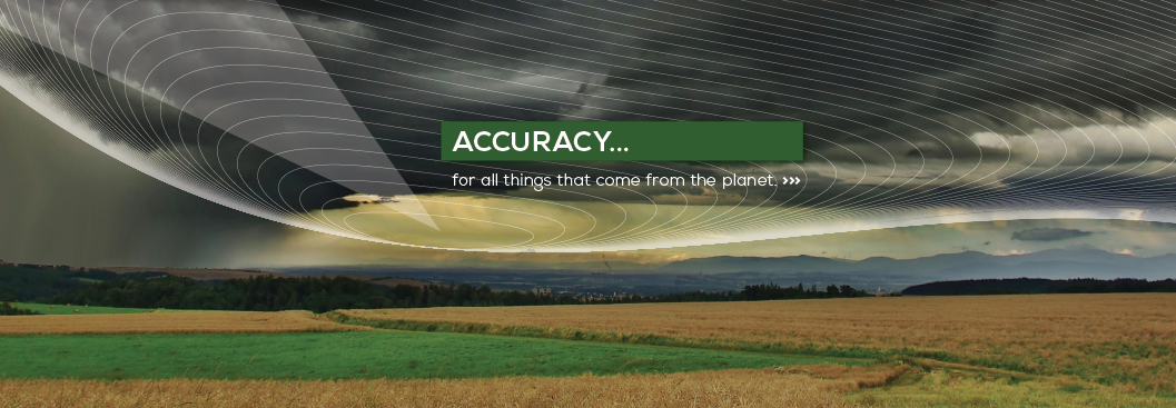
Tempus Global Data has combined the very best of weather observation in space with a big data approach
Hall said, “we are so pleased to have this group of distinguished scientists join with us in this effort to put the next generation of weather sensors into GEO orbit. We think STORM is such a promising breakthrough in the way severe weather is detected and forecast, and we will be able to accelerate our success with the help of these powerful experts.”
Tempus Global Data acquired the rights to the technology from Utah State University and their research foundation, and is on track to fly the sensor aboard a hosted payload, late in 2017. Details of the launch and hosting partners is forthcoming.
Hall outlined the goals of the advisory team: to help Tempus become the first commercial entity to sell hyperspectral weather data to government and commercial enterprises. Specifically, Hall hopes to have the scientists “provide valued input on strategic direction and advocacy within the industry as to the scientific products and the form those products will take.” Hall said, “We will also look to the scientific advisory board to provide input and advice on reaching a broad customer base both private and public.”
Hall believes that the senior leadership and expertise of the team members will provide a continuing opportunity to encourage and shape useful technology research and thereby influence the weather data industry for years to come.
Hal Bloom, will act as chairman of the group. Bloom is Group Vice President of the Science and Engineering Division with STC (Science and Technology Corporation) and supports a wide range of NOAA, NASA, and commercial programs primarily in data systems, software engineering, science algorithm development, and instrument calibration/validation support. He is a former senior leader at NASA/NOAA and helped manage the joint development of GOES-R satellite and ground system. In addition, Bloom was responsible for space segment acquisition and development of the next generation Polar Orbiting weather satellites valued over $7B.
Chris Barnet, Senior Research Scientist at STC, will join him. In his role as a Physical Scientist at NOAA he was a scientific advisor and algorithm expert on the GOES-R, NASA-AIRS, EUMETSAT-IASI, and NPOESS projects. He recently was selected by NASA to lead the sounder discipline of the Suomi-NPP science team. He will provide expertise as Tempus develops new products and will provide long-range strategies in data utilization and visualization.
Dr. Larrabee Strow, is a Research Professor of Physics at the University of Maryland, Baltimore County. He worked as an atmospheric physicist for 10 years at NASA’s Goddard Space Flight Center before returning to UMBC in 1984 as an Assistant Professor. He become a full Professor in 1998 and switched to Research Professor in 2006. He is considered one of the leading authorities in the world on remote sensing of the earth in the infrared bands using high spectral resolution satellite instruments. He manages a team that provides NASA and NOAA with the radiative transfer algorithms for the retrieval of geophysical variable using AIRS, IASI, and CrIS.
Daniel Kirk-Davidoff is Chief Scientist for Weather and Climate Services at MDA Information Systems LLC, a global leader in advanced information solutions to government and commercial customers, specifically geospatial, remote sensing platforms and energy and agricultural weather forecasts. A past member of the NASA CLARREO science team, he is also an Adjunct Associate Professor of Atmospheric and Oceanic Science at the University of Maryland and has a passion for solving a wide range of climate monitoring and modeling problems.
Paul Stewart currently serves as the Director of Technology at the Space Dynamics Laboratory, a University Affiliated Research Center (UARC) for the U.S. Government, based at Utah State University in Logan, Utah. Prior to his current positions he served 29 years in the U.S. Navy culminating his career as the Commander/Director of the Naval Research Laboratory. Previously, Mr. Stewart was assigned to the Office of Naval Research as Deputy Director and Division Director; additionally he served as the U.S. National Officer to the NATO Undersea Research Center, in Italy. Additionally, Mr. Stewart served as the Director, National Ice Center in Washington, DC, a NOAA, USN and USCG agency and also as the Special Assistant to the Secretary of the Navy.
Dr. Scott Jensen is the Director of Advanced Weather Systems at Utah State University. Scott has spent the last 16 years in the development of weather sensor technology and leads the efforts to develop the Utah State University-built Sounding & Tracking Observatory for Regional Meteorology instrument (STORM) under an exclusive agreement. It leverages the GIFTS sensor built for NASA by USU, designed to be flown, primarily, as a hosted payload aboard commercial telecommunications satellites.
The first meeting of the team yielded important strategic recommendations about Tempus’ product offerings which will help numeric weather modelers predict storms and severe weather in clear skies.
Tempus is a data company, headquartered in Ogden, Utah, that provides highly complex views of the atmosphere in three dimensions. Flying in geo-synchronus orbit, the Storm sensor takes persistent and recurring slices of the atmosphere, which result in unprecedented accuracy and clarity. Data visualization tools will be created using algorithms that combine in-depth views of water vapor, temperature and wind velocity, enabling views of weather conditions that may be forming in clear skies.