
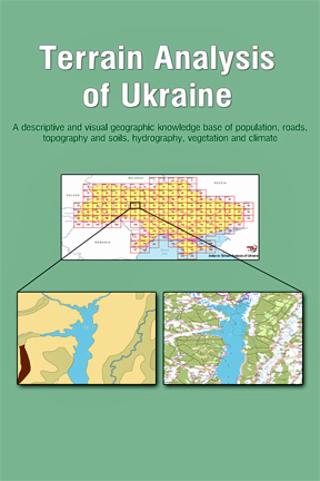
[SatNews] East View Geospatial, a provider of content-rich cartographic products, has published Terrain Analysis of Ukraine in e-book form.
The electronic publication contains more than 150 color topographic maps supplemented with locally sourced reports on demographics, roads, terrain, soils, hydrology, vegetation and climate. A searchable online database of the e-book’s content is also offered, and a hardcover print version will be available early 2015 at the same price. An XML version, ideal for users needing to integrate or edit the data in their own systems, is also available.
“Terrain Analysis of Ukraine provides simple and easy access to once-classified geographic intelligence covering the entire country,” said East View Geospatial CEO Kent D. Lee. “We prepared this publication for use by peacekeeping forces, humanitarian organizations, embassy personnel, local authorities and international business investors.”
Written in English and accessible on computers, tablets and smart phones in PDF format, the publication was created by East View Geospatial analysts who interpreted detailed terrain and geographic reports printed on the reverse sides of 1:200,000-scale topographic maps. These maps were originally produced by Ukrainian national mapping authorities using on-site surveys, local knowledge and long-term observations.
“As with all East View Geospatial products, locally sourced information provides value and sets this publication apart from the others,” says Lee. “The full-color maps show terrain geometry and place names in vivid detail, while the written analyses offer geographic insights, such as when a river freezes, which off-road areas are traversable in different seasons, and which construction materials are used in local houses, just to name a few.”
The Terrain Analysis of Ukraine e-book may be purchased at http://www.eastviewpress.com. The next e-book, Terrain Analysis of Syria, will be published later in 2015.
The Ukraine publication is one of several geospatial products developed through East View’s long-standing partnership with Ukraine’s national mapping agency. The source materials for the e-book and related geospatial data sets include the following detailed geographic intelligence:
- Populated Places – Population levels, road conditions, building characteristics, water resources, housing density, sanitary conditions, and telecommunications infrastructure.
- Roads/Bridges – Load capacities, surface types, width, elevation, and seasonal conditions.
- Topography and Soil – Terrain altitude and slope, soil types and water tables.
- Hydrography – Major rivers including widths, depths, flow rates, banks/islands, silting, freezing, pollution, and conditions affecting use.
- Vegetation – Grassy, forested, or shrub covered; tree heights and types; predominant grasses and crops cultivated.
- Climate – Temperature range by season, snow, rainfall and wind conditions.
In addition, East View has recently made available hundreds of previously unpublished 1:10,000-scale digital topographic GIS data sets covering 500 cities and towns in all 27 Ukraine provinces and province-level units. Most of these urban topographic data sets are current from 2011-2014 and cover nearly two-thirds of Ukraine’s population.
The Ukraine e-book and database is the second in a series of terrain analysis products from East View Geospatial. The first was Terrain Analysis of Afghanistan, which is still available for sale through East View Press. Leveraging its extensive library of locally sourced reports, databases, books and cartographic resources for much of the Middle East, Asia, Africa and Russia, East View is now working on terrain analysis maps and related products for Syria, Iran, Myanmar and China.
Visit http://www.eastviewpress.com/Books/TerrainAnalysisofUkraine.aspx for more information.