
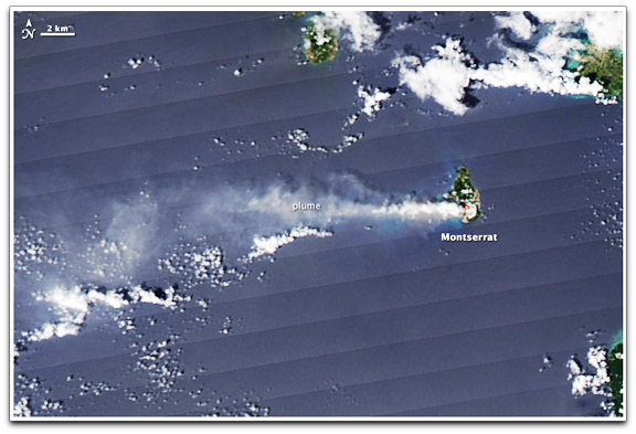
This natural-color image was acquired at 3:25 p.m. local time on October 13, 2009, by the Moderate Resolution Imaging Spectroradiometer (MODIS) aboard NASA’s Aqua satellite. A plume of ash and steam, possibly topped by clouds, extends west from Soufrière Hills. The Air Force Weather Agency reported ash at flight level 200 (6,100 meters). MODIS also detected a hot spot (outlined in red) at the volcano’s summit, likely from the lava dome. The diagonal lines stretching across the image are an artifact of the MODIS sensor.