
Text credit: Rob Gutro, NASA's Goddard Space Flight Center
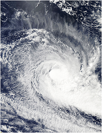
NASA's Aqua satellite is armed with several instruments that provide scientists with data on tropical cyclones. The Moderate Imaging Resolution Spectrometer, or MODIS, captures high resolution visible and infrared images. The Atmospheric Infrared Sounder, or AIRS instrument, captures infrared, visible and microwave imagery (coupled with another instrument on Aqua). AIRS satellite imagery from April 5 revealed there were still some high and strong thunderstorms to the west of Robyn's center. The MODIS instrument satellite image also reflects that finding because the higher thunderstorms are visible and appear as of the thunderstorm tops are bubbling up in the west side of the storm.
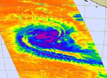
AIRS captured in infrared image of Tropical Storm Robyn on April 5 at 07:29 UTC (3:29 a.m. EDT) and there were still some strong, high thunderstorms (purple) to the west of the storm's center. This image clearly shows that Robyn is no threat to any land areas.