
[SatNews] ESA’s CryoSat satellite measured the storm surge from the recent North Sea storms, as high waters passed through the Kattegat sea between Denmark and Sweden.
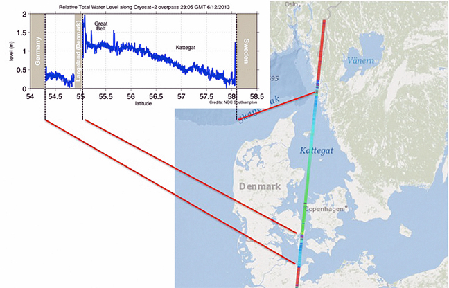
Sea-surface height over the Kattegat sea as measured by CryoSat on 6 December 2013.
Graph courtesy of ESA/NOC.
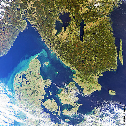
This Medium Resolution Imaging Spectrometer (MERIS) image shows part of Scandinavia, formed by Norway (in the top left corner of the image), Sweden (in the top part of the image) and Denmark (in the bottom part of the image). The part of Sweden shown in the image (south central Sweden) is a lowland with many lakes (seen in black colour), including the largest lakes in the country, Lake Vänern and Lake Vättern. The Lake Vänern, the largest one, drains southwest by the Göta River to the strait of Kattegat at Göteborg (in bright colour in the image). Göteborg, second largest city in Sweden after Stockholm, is the principal port of the country and site of the Volvo automobile-manufacturing plant. Image coutesy of ESA.
From December 5th through 6th, a major storm passed through northern Europe, causing flooding, blackouts, grounding flights and bringing road, rail and sea travel to a halt. As the storm coincided with a period of high tides in the North Sea, there were extremely high sea levels—a ‘storm surge’. In the UK, sea levels were at their highest since the 1953 North Sea Floods, while in Germany, parts of Hamburg were flooded. On Friday night, CryoSat passed over Kattegat, providing an estimate of total water levels. The observations matched predictions, helping to confirm these models.
The measurements were made by CryoSat’s radar altimeter that—although designed to measure sea-ice thickness—is providing outstanding results over sea and, especially, coastal areas.Until recently, altimeter measurements of sea-level height could only be made over open oceans because of land interference closer to the coast. In the last few years, however, progress has been made in reducing these effects, also thanks to the new generation of radar altimeters being heralded by CryoSat. This has allowed scientists not only to map water levels closer to the coast, but also profile land surfaces and inland water targets such as small lakes, rivers and their intricate tributaries.
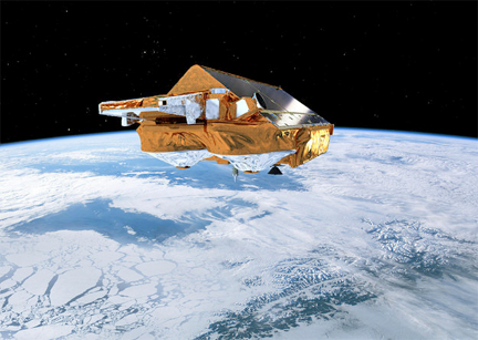
ESA’s Earth Explorer CryoSat mission is dedicated to precise monitoring of changes in the thickness of marine ice floating in the polar oceans and variations in the thickness of the vast ice sheets that blanket Greenland and Antarctica.
Image courtesy of ESA/AOES Medialab.
Altimeter measurements from space can be used to validate storm surge models as well as provide near-realtime information that can be incorporated into predictions. Under ESA’s Data User Element, the eSurge project is helping to optimise the use of altimetry and other types of satellite data to improve storm surge forecasting.
The importance of realistic storm surge models was recently demonstrated by the devastation caused by Typhoon Haiyan in south Asia, where more than 5,900 people lost their lives in the Philippines alone. “Even a small improvement to a storm surge model can have a significant impact in terms of the accuracy of warnings, and the potential to protect lives and property,” said Kevin Horsburgh from the UK’s National Oceanography Centre.
The upcoming Sentinel-3 mission being developed for Europe’s Copernicus program will carry altimeters similar to those on CryoSat, delivering more input for applications such as predicting storm surges.