

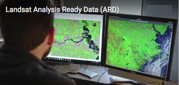
Improvements to the quality and usability of Landsat satellite data have been made with the release of a new USGS product called Landsat Analysis Ready Data (ARD).
This product will help reduce the time needed to process and analyze data and imagery, a significant advantage to scientists studying landscape changes, including changes from wildfires, hurricanes, vegetation cover, drought and other events.
A fundamental goal for Landsat ARD is to significantly reduce the amount of data processing for scientists, who currently have to download and prepare large amounts of Landsat scene-based data for time-series investigative analysis. ARD provides users with notable flexibility in how they access customized Landsat data. For example, users will have the ability to tailor requests according to specific needs in terms of geospatial regions, spectral bands and collection dates. Landsat data are the world’s longest continuously acquired collection of space-based land remote sensing data. ARD products represent more than 30 years of Landsat data available at the highest scientific quality ever produced.
This initial ARD release includes Landsat 4-8 imagery of the conterminous United States, Alaska and Hawaii. In the future, the USGS plans to add the earlier Landsat 1-5 Multispectral Scanner era imagery to the ARD product suite and eventually expand ARD to include the full global Landsat archive. ARD will serve many purposes, such as the foundational dataset for the recent USGS Land Change Monitoring, Assessment, and Projection (LCMAP) initiative. The initiative aims to characterize historical and near-real time land-cover changes across the United States.
The ARD products are based on the recently released Landsat Level-1 Collection structure. Landsat Level-1 products refer to the most basic level of processing that has been applied to a scene for them to be used in applications. This collection management structure ensures access to Landsat Level-1 products as they are acquired and a consistent archive of known data quality. The USGS generates ARD products from data acquired by the Landsat 4-5 Thematic Mapper, Landsat 7 Enhanced Thematic Mapper Plus and Landsat 8 Operational Land Imager and Thermal Infrared Sensor instruments.
Landsat ARD is created after processing Landsat Level-1 Collection scenes into Albers Equal Area Conic projection. The USGS processes these products to create top of atmosphere reflectance, brightness temperature and atmospherically corrected surface reflectance. The USGS assembles these products into “tiles” adapted from the Web Enabled Landsat Data tiling scheme. This tiling scheme ensures that each pixel in an ARD tile represents the same location on the Earth’s surface through the entire ARD time series record from 1982 to the present.
In addition to this higher-level spectral band processing of geophysical parameters, ARD includes several pixel-level quality assessment bands. These bands document the presence of sensor, solar, atmospheric and topographic conditions and traceability to the Landsat Level-1 input source scenes used in ARD.
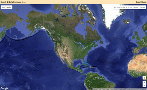
USGS EarthExplorer Data Portal.
Each ARD tile product is accompanied by comprehensive metadata that ensures full traceability to the Level-1 input source scenes as well as the versions of the algorithms and processing software used to generate them. The USGS has documented ARD product characteristics in the Landsat ARD Data Format Control Book.
ARD results from a USGS-NASA decision to make Landsat data more relevant for the next generation of information applications. Users can access Landsat ARD through the EarthExplorer data portal.