
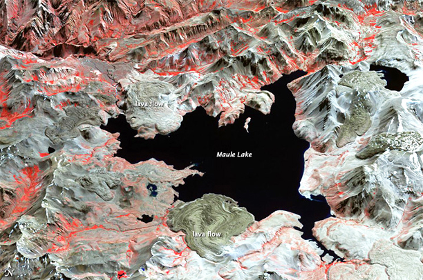
....named Laguna del Maule, roughly 15 by 25 kilometers (9 by 15 miles) across. Within the northern part of the caldera lies Maule Lake, which is surrounded by a complex volcanic landscape. This perspective image is made from data acquired by the Advanced Spaceborne Thermal Emission and Reflection Radiometer (ASTER) on NASA’s Terra satellite on April 9, 2003. ASTER produces images using infrared, red, and green wavelengths of light. In this image, vegetated areas range in color from red to pink, snow is white, water is black, and bare rock is earth-toned.
NASA image courtesy of GSFC/METI/ERSDAC/JAROS, and the U.S./Japan ASTER Science Team. Caption by Michon Scott.
Laguna del Maule holds an assortment of volcanic features, including small stratovolcanoes, lava domes, and cinder cones. Some of the most prominent features surrounding Lake Maule are lava flows. Some of those lava flows protrude into the lake, looking a little like dough spreading under its own weight. Volcanologists estimate that volcanoes at this site have been active over the past 10,000 years, but the date of the last eruption at Laguna del Maule is unknown.