
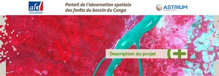
Astrium Services, via its GEO-Information business, and the Agence Française de Développement (AFD) have launched first satellite imagery portal portal to provide satellite imagery of the forests in the Congo Basin to organizations working to conserve the region’s forests. Over 600 SPOT satellite images will now be directly accessible. The space imaging portal for the Congo Basin forests was today officially opened in Paris at the REDD+ workshop, which will bring together economists, scientists, forest management organizations, specialists and technology providers working to preserve tropical forests. The event is being organized by Planet Action, Astrium’s corporate social responsibility (CSR) initiative that is helping to fight climate change through the donation of geo-information technologies.
By comparing archive imagery against new images it will now possible to track changes in the Congo Basin’s forest cover. Administrations, public institutions and NGOs working on sustainable forest governance in the region will be using the images and the accompanying value-added services to more effectively monitor land use — a key to the sustainable management of the forests in Central Africa. The data is also crucial for measuring the effectiveness of national strategies and defining plans of action as part of the REDD+ program (Reducing Emissions from Deforestation and forest Degradation).
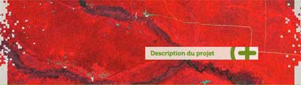
Africa before...
African forest after...
The SPOT satellite images of the Congo Basin will be made available to all organizations working on forest preservation projects that specifically focus on reducing emissions resulting from deforestation or forest degradation, preserving or increasing forest carbon storage, or promoting sustainable forest governance.
Financing for the free portal is being provided by Astrium and by the AFD as part of a broad initiative to protect the forests of the Congo Basin using space technologies. The project is being overseen by a consortium of partners including IGN France International (IGN-FI), the Centre National d’Etudes Spatiales (CNES), the Institut Géographique National (IGN), the Institut de Recherche pour le Développement (IRD) and the international branch of the Office National des Forêts (ONFi).
The satellite imagery portal for the forests of the Congo Basin is available at: Additional information is also available on the GEO-Information website of Astrium Services: here..
Astrium Services is a strong provider in the geo-information market, furthered by the integrated skills and resources of Spot Image and Infoterra. The company provides decision-makers with multiservice solutions permitting them to increase security, protect the environment, or improve their management of natural resources. It enjoys exclusive access to data from the SPOT and TerraSAR-X satellites, coupled with a complete range of space-based data sources and airborne acquisition capability enabling it to offer an unrivaled portfolio of Earth observation services and products.