
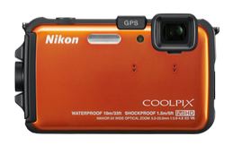
The Nikon COOLPIX AW100 is waterproof, shockproof and freezeproof, to take on all extreme adventures. It packs a 5x Zoom-NIKKOR ED glass lens and a 16.0-MP CMOS sensor to record low-light and fast-action photos and Full HD (1080p) movies. Life on the road deserves GPS + Electronic compass, so the AW100 has these too. Add a 3-inch monitor, the new Action Control for easily adjusting settings when wearing gloves plus a range of in-camera special effects.
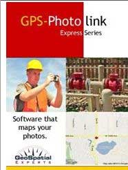
GeoSpatial Experts is bundling its easy-to-use GPS-Photo Link photo mapping software with Nikon’s new COOLPIX AW100 camera. The new GPS camera with built-in compass is the first Nikon COOLPIX built with a ruggedized body for use outdoors in almost any conditions. This bundle is the first fully ruggedized photo-mapping solution GeoSpatial Experts has been able to offer for under $900.
“The Nikon AW100 is waterproof, freeze proof, and shockproof — and it’s compact enough to fit in your pocket,” said GeoSpatial Experts President and CEO Rick Bobbitt. “Bundled with the new GPS-Photo Link 5.1, this camera is an amazing value for a business user who wants to accurately map the locations of their photos.”
The fast and light-weight COOLPIX AW100 is a point-and-shoot camera with a GPS and compass built into its ruggedized body. The AW100 provides stunning 16-megapixel image quality and Full High Definition (HD) movie recording. The Nikon AW100 offers a 5X optical, 4X digital zoom. The GPS camera is built for true underwater use to a depth of 33 feet, and it can survive impact from a fall up to five feet. It is weather resistant down to 14 degrees F. The AW100 weighs in at only 6.3 ounces.
Digital map output includes Esri shapefiles and geodatabases as well as Google Earth files. The software gives photographers the ability to enter photo attribute data that can be permanently written into the image’s EXIF header. The user can also create customized output for data sharing and compliance reporting including watermarked photos and reports in a variety of formats.
Applications of photo-mapping software span the full spectrum of business users whose jobs require accurate photographic documentation of objects and features at a specific place and time including disaster response, infrastructure assessment, asset management, engineering, environmental impact and land management, and utility mapping.
GeoSpatial Experts offers GPS-Photo Link in two editions: GPS-Photo Link GIS Pro for geospatial professionals mapping their photos in a true GIS environment, and GPS-Photo Link Express for business users who map photos on a digital or web-based map and generate reports from their photo inventories.