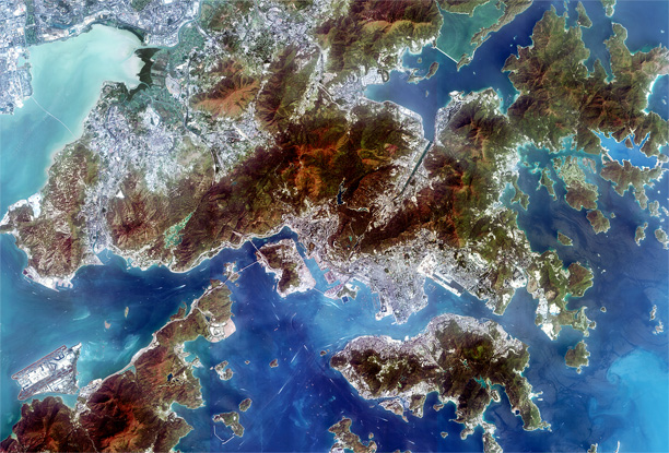
 [SatNews] PCI Geomatics now supports ZY-3 imagery within its software suite. Zi Yuan-3, or ZY-3, is China’s first civilian high resolution stereo mapping earth observation satellite. Launched from the Taiyuan Satellite Launch Center on January 9, 2012, it was declared operational on April 20, 2012.
ZY-3 is an optical imaging satellite with a Multispectral Camera (MSC), which collects imagery at a resolution of 5.8m with four spectral bands (Blue, Green, Red, Near-IR). ZY-3 also has a Three Line Array (TAC) camera, which collects panchromatic images at 2.1 m (nadir) and 3.5m (forward and backward cameras). PCI Geomatics conducted quality control on ZY-3 imagery to determine the accuracy, and found that the correction level is very precise using Rational Polynomial Coefficients (RPCs).
“We worked closely with an image collected over Hong Kong on March 2013 to assess the automated methods used to correct ZY-3 images using RPCs,” said Dr. Philip Cheng, Senior Scientist at PCI Geomatics. “Our software includes support for pansharpening, and high resolution digital elevation model extraction using imagery from the single pass stereo mode.”
Support for ZY-3 is available in Geomatica and GXL 2013.

This is a sample image of Hong Kong that has been processed and pansharpened using PCI Geomatics software.

