
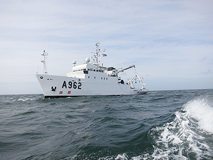
The RV Belgica is an all-purpose oceanographic research ship that spends around 200 days per year at sea, monitoring the quality of the marine environment, surveying the seabed and serving as a floating laboratory for Belgian universities and research institutes. Mainly operating in the southern North Sea, the 51 m-long vessel is run by the Belgian Navy on behalf of the Royal Belgian Institute of Natural Sciences.
Credits: RV Belgica
...Europe’s EGNOS satnav system. Results gathered by Belgium’s RV Belgica are investigating how EGNOS, initially prioritized for aircraft, can also guide marine traffic. The Belgica is an all-purpose oceanographic research ship that spends around 200 days per year at sea, monitoring the quality of the marine environment, surveying the seabed and serving as a floating laboratory for Belgian universities and research institutes. Mainly operating in the southern North Sea, the 51m-long vessel is run by the Belgian Navy on behalf of the Royal Belgian Institute of Natural Sciences. Usually gathering data from the sea, the Belgica is now also receiving data from the sky.
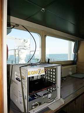
EGNOS receiver equipment board RV Belgica. The ship is constantly picking up signals from the European Geostationary Navigation Overlay Service, EGNOS, as well as signals from the first Galileo satellites in orbit, to check the system performance during different sea conditions, while the ship is moving or stationary and out to sea or approaching harbour.
Credits: RV Belgica
"We’re interesting in learning how the signals reflect—an unwanted effect known as ‘multipath’—off the sea or from harbour infrastructure or nearby ships,” added David Jimenez-Baños, checking the data. Then, close to shore, there is also the potential for interference from local ship-tracking radar.
Covering all European territory via a trio of geostationary satellite transponders, EGNOS is an augmentation system that sharpens the accuracy of US GPS signals. EGNOS corrects for interference from the electrically active ‘ionosphere’ layer of the atmosphere and adds information on reliability for a range of general and safety-critical uses across the continent. Europe’s equivalent to the US WAAS system, EGNOS is now available for guiding aircraft approaches to airport runways. Designed by ESA, the European Commission and Eurocontrol – the European Organisation for the Safety of Air Navigation – EGNOS can also be used for surface transport on both land and sea.