[SatNews] Data from the Meteosat satellite has been used to measure the temperature of lava at a remote volcano in Africa.
The scientists compared data from the Spinning Enhanced Visible and InfraRed Imager (SEVIRI) on board Meteosat with ground data from a thermal camera, to show the temperature of the lava lake at Nyiragongo, in the Democratic Republic of Congo. The technique was pioneered in Europe, and the researchers say it could be used to help monitor volcanoes in remote places all over the world.
“I first used the technique during a lava fountain at Mt. Etna in August 2011,” said Dr. Gaetana Ganci, who worked on the study with colleagues Letizia Spampinato, Sonia Calvari and Ciro Del Negro from the Istituto Nazionale di Geofisica e Vulcanologia (INGV) in Italy. “The first time I saw both signals I was really surprised. We found a very similar radiant heat flux curve—that's the measurement of heat energy being given out—from the ground-based thermal camera placed a few kilometers from Etna and from SEVIRI at 36,000km above the Earth.”

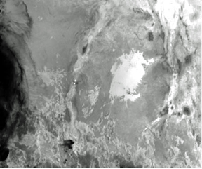
Heat anomalies on Nyiragongo and Nyamuragira show as white pixels in SEVIRI infrared.
Image courtesy of EUMETSAT.
Transferring the technique to Nyiragongo was important—partly because the exposed lava lake can yield data important for modelling shallow volcanic systems in general, but more importantly because advance warning of eruptions is necessary for the rapidly expanding city of Goma nearby. The research, published in the Journal of Geophysical Research: Solid Earth is the first time in which Nyiragongo’s lake has been studied using ground-based thermal images in addition to satellite data to monitor the volcano's radiative power record.

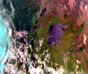
False color image from SEVIRI.
Image courtesy of EUMETSAT.
Dr. Ganci and her colleagues developed an algorithm they call HOTSAT to detect thermal anomalies in the Earth’s surface temperature linked to volcanoes. They calculate the amount of heat energy being given out in a target area based on analysis of SEVIRI images. Combining the frequent SEVIRI images with the more detailed but less frequent images from NASA’s Moderate Resolution Imaging Spectroradiometer (MODIS), they showed that temperature anomalies could be observed from space before an eruption is underway. They believe that space-based observations can be a significant help in the difficult task of predicting volcanic eruptions, but that providing advance warning will never be easy.
“Satellite data are a precious means to improve the understanding of volcanic processes. There are cases of thermal anomalies being observed in volcanic areas just before an eruption,” said Ganci. “Combining different kinds of data from the ground and from space would be the optimal condition – including infra-red, radar interferometry, seismic measurements etc. But even in well-monitored volcanoes such as Mt. Etna, predicting eruptions is not a trivial thing.”

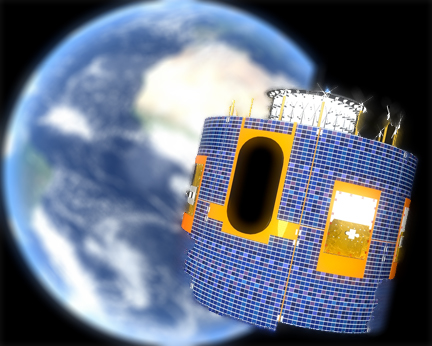
Artistic rendition of a Meteosat satellite.
Image courtesy of EUMETSAT.
The team developed HOTSAT with a view to making an automatic system for monitoring volcanic activity. They are now developing a new version of HOTSAT. This should allow the processing of all the volcanic areas that can be monitored by SEVIRI in near-real time. Continuing ground-based observations will be needed for validation.
“For remote volcanoes, such as Nyiragongo, providing reliability to satellite data analysis is even more important than in Europe. Thanks to ground-based measurements made by Pedro Hernández, David Calvo, Nemesio Pérez (ITER, INVOLCAN Spain), Dario Tedesco (University of Naples, Italy) and Mathieu Yalire (Goma Volcanological Observatory), we could make a step in this direction,” says Ganci.
"This study shows the range of science that can be done with Meteosat,” says Dr. Marianne Koenig, EUMETSAT’s atmospheric and imagery applications manager for the Meteosat Second Generation satellites, “And opens up the possibility of monitoring isolated volcanoes."
The EUMETSAT infosite is accessible via http://www.eumetsat.int/

