Airbus Defence and Space and The Climate Corporation (Climate), a subsidiary of Bayer, have announced a new global agreement to deliver best-in-class, frequently updated satellite imagery from Airbus to farmers through The Climate Corporation’s Climate FieldView™, an industry-leading platform of digital agriculture.

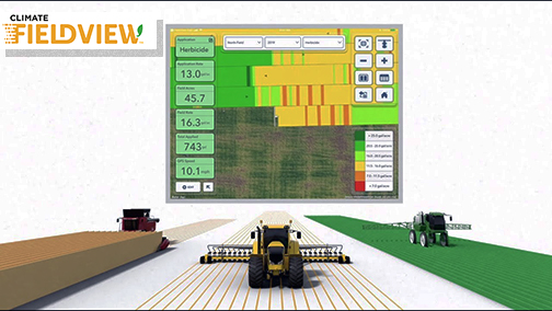
As a result, farmers who use Climate FieldView can access high-resolution data of their fields - from the Airbus SPOT 6, SPOT 7 and Pléiades satellites - throughout the growing season. This will give FieldView customers the ability to more precise monitor crop health and performance, helping them take action in the field before yield is impacted at the end of the season. They will also be able to visualize this satellite imagery alongside other data layers in their FieldView account, including planting and yield data, to unlock new insights about crop health.
The large swath and coverage capabilities of the SPOT satellites enable mapping at a national level down to individual farmland parcels, while the Pléiades satellites can be used to pinpoint details in specific areas, thanks to its combination of sub-meter resolution and multi-spectral bands. The complementary of SPOT and Pléiades resolutions, swaths and revisits, is crucial for effectively monitoring crops more precisely and helps enable more-informed decision-making.
The Climate Corporation’s mission is to help all the world’s farmers sustainably increase their productivity through the use of digital tools. First launched in the United States in 2015, the company’s Climate FieldView platform gives farmers a deeper understanding of their fields so they can make more informed operating decisions to optimize yields, maximize efficiency and reduce risk. FieldView is currently on more than 60 million paid acres across the United States, Canada, Brazil and Europe. It has quickly become the most broadly connected platform in the industry and will continue to expand into other global regions over the next few years.
François Lombard, Head of Intelligence Business at Airbus Defence and Space, said the company is pleased to be working with The Climate Corporation to enhance FieldView by providing them with access to updated, cloud-free images within the time frame required to efficiently monitor crops at each key growth stage.
Steven Ward, Senior Director of Geospatial and Weather Sciences at The Climate Corporation, added that high-quality satellite imagery integrated into a farmer’s Climate FieldView account can bring in more consistent and invaluable field-level insights. This partnership with Airbus supports Climate’s commitment to deliver the most robust imagery ecosystem on the farm, helping farmers make important decisions tailored precisely to their individual fields.

