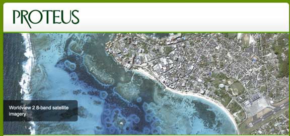
...the Red Sea coastline in just 10 days. Proteus derived the bathymetric data from DigitalGlobe® WorldView-2 high-resolution, 8-band satellite imagery.
“If this project had been undertaken by boat, it would have taken six to eight months due to government permitting requirements and shallow-water navigation obstacles,” said David Critchley, Proteus CEO. “Satellite-derived bathymetric surveys are completed at a fraction of the time and cost and within geographic locations where ecological constraints, submerged reefs, or political issues hamper traditional hydrographic mapping methods.”
Proteus completed the project using a bathymetric and seafloor mapping method developed with its exclusive partner EOMAP GmbH & Co.KG, who specializes in deriving cartographic products from multispectral satellite imagery. In the Red Sea, the satellite bathymetry process successfully extracted seafloor elevation measurements to depths of 20 meters with a four-meter point density at distances up to five kilometers off the Saudi Arabian Coast. The bathymetric data supported for an environmental assessment being conducted by Sogreah, a French engineering consulting firm, in preparation for construction of a new power plant south of Jeddah.
Since 2011, Proteus has been producing seafloor survey and seabed classification projects using multispectral satellite imagery and the product generation technology of EOMAP. These mapping projects have been delivered for environmental, oil & gas, marine biology and other coastal zone applications in Europe, the Middle East and Caribbean. Compared with traditional hydrographic mapping methods such as airborne LiDAR or marine sonar, Proteus' satellite-derived bathymetry and seabed classification services offer many advantages including provides instant large-area coverage, rapid project delivery and enables frequent area refresh to track change. With satellites there are no mobilization fees or local permissions necessary, and remote-sensing techniques allows safe acquisition of data in sensitive, challenging and remote areas. Importantly, the Proteus surveying technique also has a high accuracy, enabling customers to use the derived products for engineering, environmental monitoring and strategic geospatial planning applications.


