
 [SatNews] CGI (NYSE: GIB) (TSX: GIB.A) has successfully delivered a new system to the European Space Agency (ESA) to provide near-real-time access to images acquired over Europe by the new Landsat-8 satellite, completing the system design, development and deployment in record time.
Operated by the U.S. Geological Survey (USGS), the Landsat-8 satellite is now in orbit, observing the Earth at medium resolution (15-30m) from a distance of 438 miles (705 kilometres). The satellite has been operational since May 30th, 2013, capturing regular images of the Earth's surface for monitoring land usage, crop monitoring, water resources and other changes to the planet, and adding to the unparalleled 40-year data archives of the USGS.
Under contract to ESA, CGI developed the system to receive data directly from the satellite, process it into a useable visual format, and make it available to end-users in “near real time”, which ESA defined as being within 3 hours of the image being received at a European ground receiving station. CGI worked with specialist companies Spacemetric of Sweden and Kongsberg Spacetec of Norway to design, develop, integrate, validate and deliver the complex data acquisition, processing, archiving and dissemination system.
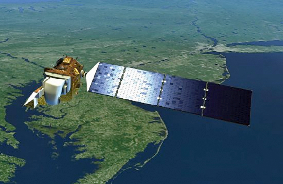
Artistic rendition of the Landsat-8 satellite.
Commenting on the success, Dr. Gunther Kohlhammer, head of the Earth Observation Ground Segment at the European Space Agency, said, “We are delighted with our new Landsat-8 data processing system and online portal, and are now looking forward to start distributing Landsat-8 data as announced at the Living Planet Symposium to give Europe’s scientific community the fastest possible access to medium-resolution land monitoring data available today. It is a commendable achievement of CGI and its partners to have developed and delivered this complex system in such a short time.”
Cock Overbeek, Director for Space at CGI, added, “Our work on the ESA Landsat-8 portal builds on our more than 30-year heritage of delivering reliable, mission-critical systems for the space sector. It demonstrates our deep understanding of ESA’s requirements and aspirations in the Earth Observation domain, as well as our ability to work flexibly in response to evolving requirements and form strong industrial partnerships with European specialist space-sector companies.”
The ESA Landsat-8 portal, operated by CGI, is now online at https://landsat8portal.eo.esa.int/portal/. It is free and open for anyone to search the catalog and download "full resolution browse" images, although user registration is required for access to the full products.