Storm-Surge and Real-Time Sensors
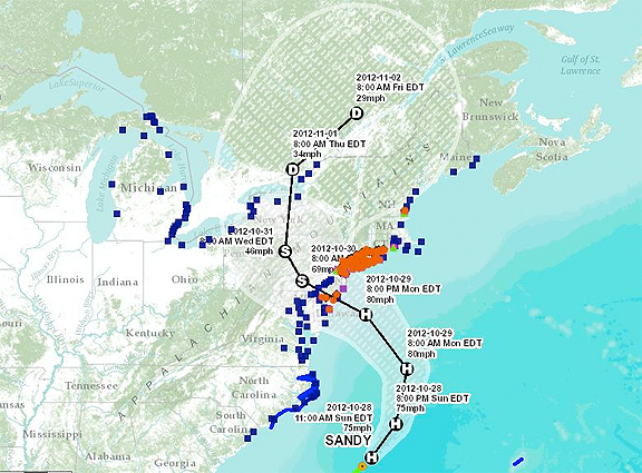
USGS Storm-Tide Mapper, showing all data collected by the storm-surge sensors and the USGS streamgage network.
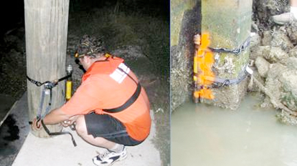
A USGS scientist installs a storm-surge sensor for Hurricane Rita in 2005, the first storm in which these sensors were deployed.
All data collected by these sensors and the existing USGS streamgage network are available on the USGS Storm-Tide Mapper.
Working with various partner agencies such as NOAA, FEMA, and the U.S. Army Corps of Engineers, the USGS is strapping the storm-surge sensors—typically about 1-½ inches wide and a foot long—to piers, docks or other structures in the water expected to withstand the storm. They will record the precise time the storm-tide arrived, how ocean and inland water levels changed during the storm, the depth of the storm-tide throughout the event, and how long it took for the water to recede. This information gathered will be used to assess storm damage, discern between wind and flood damage, and improve computer models used to forecast future coastal change.
Anticipated Coastal Change
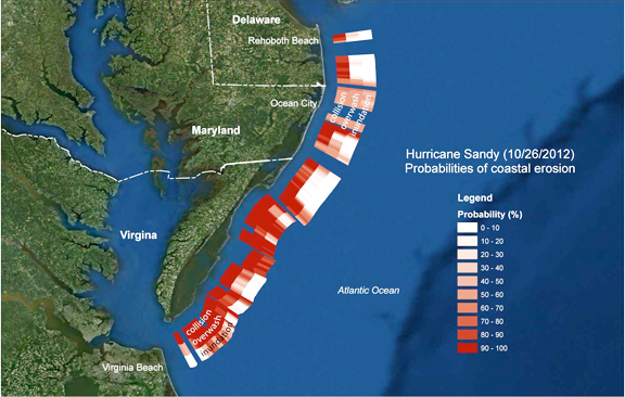
USGS models showing likely erosion, overwash, and inundation along the Delmarva Peninsula.
Nearly three quarters of the coast along the Delmarva Peninsula is very likely to experience beach and dune erosion as the storm makes landfall, while overwash is expected along nearly half of the shoreline. Overwash, the landward movement of large volumes of sand from overtopped dunes, is forecasted for portions of the east coast with the projected landfall of the storm. The severity of overwash depends on the strength of the storm, the height of the dunes, and how direct a hit the coast takes. Fifteen percent of the Delmarva coastline is very likely to be inundated by waves and storm surge. In these areas, waves and storm surge would transport large amounts of sand across coastal environments, depositing sand both inland and offshore and causing significant changes to the landscape. The impact of previous storms on sandy beaches along the mid-Atlantic Coast has made them increasingly vulnerable to significant impacts such as erosion.
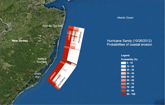
USGS models showing likely erosion, overwash, and inundation along the New Jersey Shoreline.
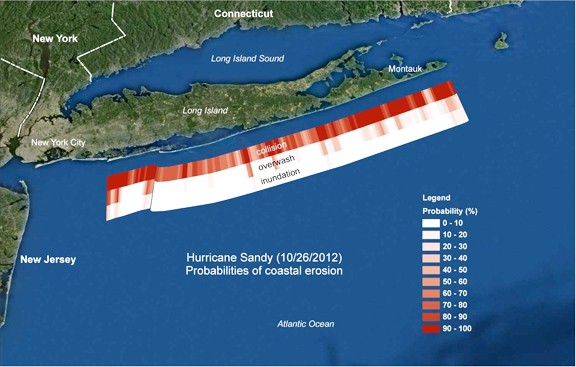
USGS models showing likely erosion, overwash, and inundation along the Long Island southern coastline.

