Here's Looking @ Earth... Planes, Instruments + Satellites... (JPL | NASA)
 NASA's ER-2 research aircraft, with JPL's advanced AVIRIS instrument aboard, flew from California to Texas on May 6, 2010, for a series of flights to map the Gulf of Mexico oil spill and coastal areas. Image credit: NASA
 As part of the national response to the spill and at the request of the
National Oceanic and Atmospheric Administration (
NOAA),
NASA deployed its instrumented research aircraft, the
Earth Resources-2 (
ER-2) to the Gulf on May 6. The ER-2, outfitted with
JPL's
Airborne Visible/Infrared Imaging Spectrometer (
AVIRIS) and the
Cirrus Digital Camera System, supplied by NASA's
Ames Research Center, Moffett Field, California, was sent to collect detailed images of the Gulf of Mexico and its threatened coastal wetlands. NASA is also making extra satellite observations and conducting additional data processing to assist NOAA, the U.S. Geological Survey, and the Department of Homeland Security in monitoring the spill.
NASA pilots flew the ER-2 from NASA's
Dryden Flight Research Center in California to a temporary base of operations at
Johnson Space Center's
Ellington Field in Houston. Along the way, the plane collected data over the Gulf coast and the oil slick to support spill mapping and document the condition of coastal wetlands before oil landfall. The ER-2 made a second flight on May 10, and more flights are planned. The AVIRIS team, led by JPL's
Robert Green, is measuring how the water absorbs and reflects light in order to map the location and concentration of oil, which separates into a thin, widespread sheen and smaller, thick patches. Satellites can document the overall extent of the oil but cannot distinguish between the sheen and thick patches. While the sheen represents most of the area of the slick, the majority of the oil is concentrated in the thicker part. AVIRIS should be able to identify the thicker parts, helping oil spill responders know where to deploy oil-skimming boats and absorbent booms.
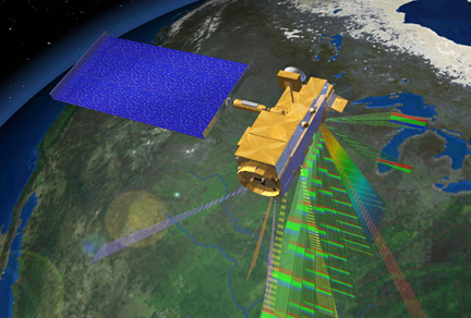 Images from space taken by instruments on Terra and other NASA satellites are providing disaster response officials with regular views of the extent of the oil spill. Credit: NASA
Researchers also plan to measure changes in vegetation along the coastline and assess where and how oil may be affecting marshes, swamps, bayous, and beaches that are difficult to survey on the ground. The combination of satellite and airborne imagery will assist NOAA in forecasting the trajectory of the oil and in documenting changes in the ecosystem. From the outset of the spill on April 20, 2010, NASA has provided satellite images to federal agencies from the
Moderate Resolution Imaging Spectroradiometer (
MODIS) instruments on NASA's
Terra and
Aqua satellites; the Japanese
Advanced Spaceborne Thermal Emission and Reflection Radiometer (
ASTER) on
Terra; and the
Advanced Land Imager (
ALI) and
Hyperion instruments on NASA's
Earth Observing-1 (
EO-1) satellite. All of these observations have been funneled to the
Hazards Data Distribution System operated by the
USGS. The ASTER U.S. science team is located at JPL. With its very wide field of view, MODIS provides a big picture of the oil spill and its evolution roughly twice a day. The Hyperion, ALI, and ASTER instruments observe over much smaller areas in finer detail, but less often (every two to five days).
 Views of the Gulf of Mexico oil spill from the Advanced Land Imager on NASA's Earth Observing-1 satellite, like this one from April 25, are giving disaster response officials close-up views of the spill. Credit: NASA
Other NASA satellite and airborne instruments are collecting observations of the spill to advance basic research and to explore future remote-sensing capabilities. From space, the JPL-built and managed
Multi-angle Imaging Spectroradiometer (
MISR) instrument on Terra, JPL's
Atmospheric Infrared Sounder (
AIRS) instrument on Aqua, and the
Cloud-Aerosol Lidar with Orthogonal Polarization (
CALIOP) on the joint NASA-France
CALIPSO satellite are collecting data. Another NASA research aircraft, the
King Air B-200 from
Langley Research Center in Hampton, Virginia, was previously scheduled to fly to California this week but changed its flight plan to collect data over the area of the oil spill. It completed its first flight over the spill on May 10. The
High Spectral Resolution Lidar onboard the plane uses pulses of laser light to locate and identify particles in the environment. Led by
Chris Hostetler of Langley, the lidar provides measurements similar to those from the CALIOP instrument on CALIPSO. Data from these space-based and airborne lidars will be used to investigate the thickness of the oil spill below the surface of the water and evaluate the impacts of dispersants used to break up the oil.
Topical Tags :
Regional Tags :
