
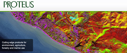
[SatNews] Proteus FZC, a provider of satellite-derived mapping solutions, delivered accurate bathymetric and seafloor classification maps for a joint UK-France amphibious military exercise on the Island of Corsica.
In the pilot managed by the UK Hydrographic Office (UKHO), Proteus partnered with DigitalGlobe to derive accurate bathymetric measurements and identify four seabed types to a depth of 12 meters from multispectral satellite imagery without ground control.
“We completed the Corsica coastal marine mapping project at about one-tenth the time and cost of traditional sonar or LiDAR,” said Proteus CEO David Critchley. “Because the data is derived exclusively from satellite imagery, we leave no environmental footprint and face no airspace restrictions.”
For the joint military operation, the British and French armed forces requested detailed information about water depth and the submerged seabed along specific sections of the Corsican coastline so that amphibious military vehicles could be launched from larger vessels anchored offshore and safely landed on the island’s beaches. The custom maps created by Proteus were used by the military to select precisely where the landings would occur.
“The vertical accuracy of our bathymetric maps was verified at 10-15 percent of water depth,” said Critchley. “If ground truth data were available, the measurements would have been accurate to a solid 10 percent of depth.”
Working with eight-band multispectral image data with two-meter resolution collected by DigitalGlobe’s WorldView-2 satellite, the Proteus-led team achieved the bathymetric measurements in Corsica’s Mediterranean coastal zone to a total depth of 12 meters. In a separate processing procedure, the team also extracted four critical seafloor types from the imagery – sand, rock/debris, vegetation and mixed seabed.
Since 2011, Proteus has been producing seafloor survey and seabed classification projects using multispectral satellite imagery. The product generation technology that can be carried out in a fraction of the time and cost of traditional methods. These mapping projects have been delivered for environmental, oil and gas, marine biology and other coastal zone applications in Europe, the Middle East and Caribbean. Derived products have high accuracy, meeting the requirements of engineering, environmental monitoring and strategic geospatial planning applications.