


[SatNews] The Japan Meteorological Agency (JMA) has released the first images taken with the Exelis-built (NYSE: XLS) Advanced Himawari Imager (AHI), which captured a sunlit and cloud-covered Japan, Pacific Ocean and Australia.
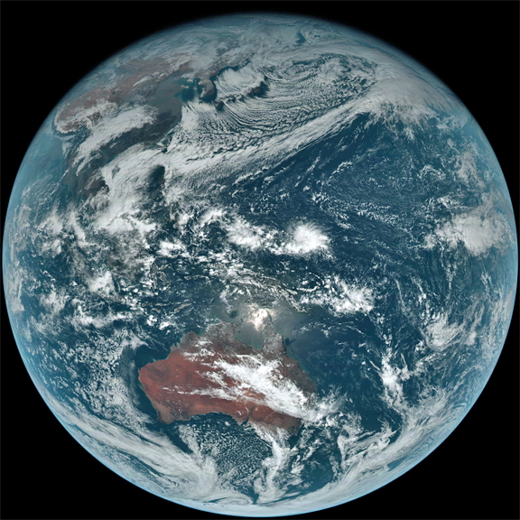
At 02:40 UTC on 18 December 2014, the first images from all 16 bands were captured by JMA's Himawari-8 next-generation geostationary meteorological satellite, which was launched on October 7, 2014.
Testing and checking of the Himawari-8 system, including related ground facilities, are going well. Himawari-8 is scheduled to start operation in mid-2015.
True-color composite (Band 1 (blue), Band 2 (green), Band 3 (red))
For more information: http://www.data.jma.go.jp/mscweb/en/himawari89/index.html—*Link to MSC/JMA
Exelis delivered the AHI to Mitsubishi Electric Corporation a year ago for integration into JMA’s Himawari-8 weather satellite which was launched in October. The images were taken in 16 visible and infrared bands, including three-color visible bands. The newly released Himawari images demonstrate a significant increase in detail coming from the high-resolution channels and the information available from the 11 additional bands. As the first in a series of Exelis next-generation geostationary imagers to be launched, the AHI will improve weather forecasts and early severe weather warnings in Eastern Asia and the Western Pacific. A second imager was delivered to Japan in August for Himawari-9, scheduled to launch in 2016.
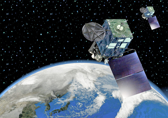
Artistic rendition of the JMA's Himawari-8 weather satellite.
The Himawari imagers are based on the Exelis Advanced Baseline Imager (ABI) designed and built for the National Oceanic and Atmospheric Administration (NOAA)’s next-generation Geostationary Operational Environmental Satellite-R (GOES-R) constellation. The first satellite launches in 2016. As part of the Exelis intelligence, surveillance, reconnaissance and analytics strategic growth platform, these advanced instruments will provide better insight into the makeup of storms, higher-resolution images and will observe full-disk images of Earth three times faster than today's capability. They will also be used to observe the Earth's surface including fires, ice, ocean color, vegetation, clouds, and land and sea surface temperatures.
“These new instruments are the first upgrades in geostationary weather imaging capability in more than 10 years. The quality of the data shows the benefit of this advanced technology,” said Eric Webster, vice president for weather systems for Exelis. “When the 2015 typhoon seasons starts, the Japan Meteorological Agency will have better, faster and more accurate data for improved severe storm forecasting.”
Exelis has delivered four flight imagers (two for the United States and two for Japan) and is in the process of building and delivering another three advanced imagers for South Korea and the United States. Exelis has provided every geostationary imager and sounder to the U.S. government since 1994 and has also built the current geostationary imagers flown by Japan and South Korea.
The Exelis infosite may be accessed at http://www.exelisinc.com/pages/default.aspx
The JMA infosite is located at http://www.jma.go.jp/jma/indexe.html