
 [SatNews] Harris Corporation (NYSE:HRS) has installed and integrated a majority of the hardware and software that forms the network infrastructure for the ground segment of the National Oceanic and Atmospheric Administration's (NOAA) Geostationary Operational Environmental Satellite-R Series (GOES-R) program—GOES-R will be a primary tool for detecting and tracking hurricanes and severe weather.
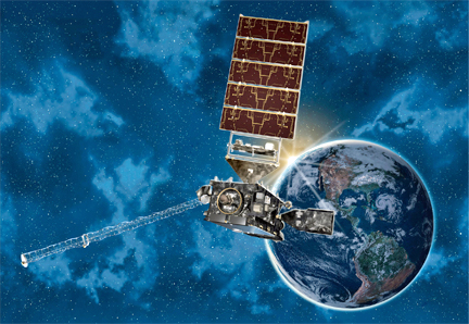
Artistic rendition of NOAA's GOES-R satellite.
Image courtesy of NASA.
Harris has installed and tested 89 of 155 racks of equipment at three NOAA satellite operations facilities located in Suitland, Maryland; Wallops Island, Virginia; and Fairmont, West Virginia. The installations include the telecommunications infrastructure that enables the sites to communicate and exchange data with each other. Harris also delivered the Release Mission Management software, which represents a significant incremental increase in capability needed for satellite and operational readiness. The software significantly improves ground system capabilities including enhanced, real-time command and control of satellites; complete mission planning and scheduling; and a telemetry archive system.
"The ongoing, incremental deliveries of Harris systems enable NOAA satellite operators and weather monitoring organizations to prepare for the changes associated with GOES-R well in advance of the first satellite launch in 2016," said Romy Olaisen, vice president, Civil Programs, Harris Government Communications Systems.
Harris is the prime contractor and systems integrator for the GOES-R Ground Segment contract. The system will form an enterprise-wide backbone capable of ingesting, processing and distributing 40 times more data than current systems to NOAA’s National Weather Service and more than 10,000 other direct users. The advanced spacecraft and instrument technology on the GOES-R series will enable more accurate weather forecasts by supplying meteorological data to NOAA with much greater detail — and significantly faster — than existing GOES satellites.
The Harris infosite: http://www.harris.com/