
NASA Earth Observatory image by Jesse Allen and Robert Simmon, using data from NASA/GSFC/METI/ERSDAC/JAROS, and U.S./Japan ASTER Science Team. Lower photograph courtesy of the Great Basin National Incident Management Team. Caption by Adam Voiland.
Instrument: Terra - ASTER
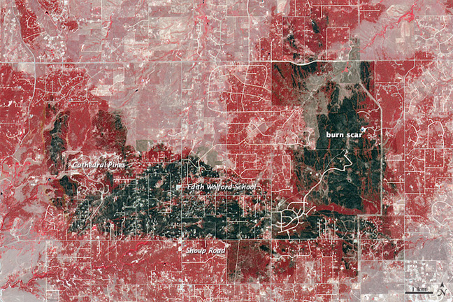
The Advanced Spaceborne Thermal Emission and Reflection Radiometer (ASTER) on the Terra satellite acquired this view of the burn scar on June 21, 2013. Vegetation-covered land is red in the false-color image, which includes both visible and infrared light. Patches of unburned forest are bright red. Unburned grasslands are pink. The darkest gray and black areas are the most severely burned. Buildings, roads, and other developed areas appear light gray and white. The lower image, a photograph taken on June 20, shows a charred section of Black Forest.
The most severe damage occurred north of Shoup Road, but the severity varied widely by neighborhood. Cathedral Pines, for instance, escaped largely unscathed. Many residents of that neighborhood put rocks around their homes, removed vegetation and dead trees from their yards, avoided using mulch, and followed other fire prevention strategies that helped keep flames back long enough for fighters to save homes, the Denver Post reported.
One key building that escaped the flames was Edith Wolford elementary school. Though it was in the middle of an area that was severely burned, the school survived intact partly because of the large, treeless parking lot surrounding it.
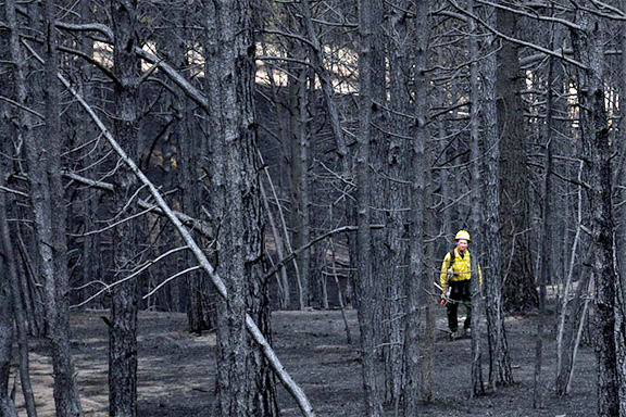
The aftermath of the Colorado Black Forest fires.