Here's Looking @ Earth... Much Of Russia Burns To A Crisp (NASA—EO)
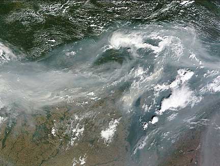
Smoke over Western Russia Image Credit: NASA/MODIS Rapid Response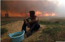
A man sits on the ground while a house burns due to severe heat, outside the town of Vyksa, Credit: REUTERS/Mikhail Voskresensky
Dense gray-brown smoke extends across the width of this image, a distance of about
1,700 kilometers (1,000 miles). The smoke clearly continues both east and west beyond the edge of the image, and is visible in both previous and successive orbits of the Terra satellite. The smoke is so thick that it is not possible to see the ground beneath it.
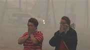
Women react while standing amidst heavy smoke
Credit: REUTERS/Mikhail Voskresensky
The wildfires have
killed at least 28 people and 3,500 have been evacuated since the fires broke out in the hottest weather since records began 130 years ago. At least 1,260 houses have been burned down.
This inferno was further fueled by peat and forest fires. In just 24 hours 30 percent more land was consumed.
Topical Tags :
Regional Tags :
