


[Satnews] On December 1, the Japan International Cooperation Agency (JICA) and the Japan Aerospace Exploration Agency (JAXA) announced their Initiative for Improvement of Forest Governance at the 21st session of the Conference of the Parties (COP21) to the United Nations Framework Convention on Climate Change (UNFCCC) in Paris.
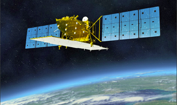
Artistic rendition of the ALOS-2 satellite.
Image is courtesy of JAXA.
The initiative will create a new tropical forest monitoring system that tracks deforestation and forest loss with JAXA’s Advanced Land Observing Satellite-2 (ALOS-2). The initiative will be conducted by a partnership between JICA and JAXA, and supporting private corporations are expected to join the initiative to contribute to the conservation of the world’s tropical forests. Activities will include building a forest monitoring system, training human resources in developing countries on how to use the system, and spreading knowledge about successful forest conservation projects around the world.
The forest monitoring system will maintain a constant watch on deforestation and forest loss in tropical regions of the globe and provide open access to its findings. With a resolution to 50 meters, the findings of the monitoring system will be updated about every six weeks on average to the JAXA website and other resources by March 2017. It is expected that these efforts will help countries with serious deforestation issues restrain illegal logging, and in the long term, help control the reduction of forests as an effective measure against climate change.
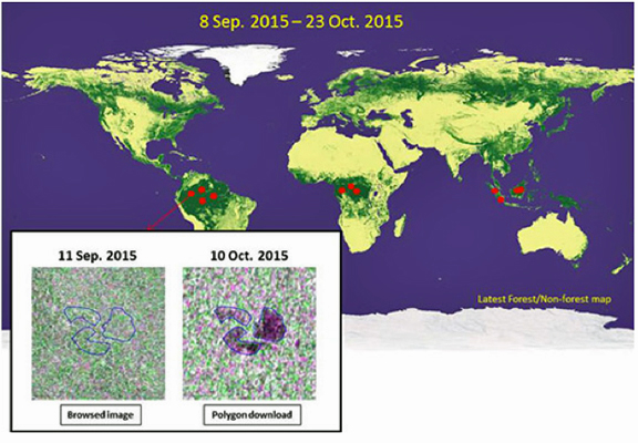
An example of how the data will be provided on the JAXA website.
Tropical forests serve as an immense storage tank to hold carbon dioxide in the form of carbon, and conserving the forests is critical in the fight against climate change. However, the loss of tropical forests continues unabated due to illegal logging and other factors, and implementing measures to stop the loss is a global priority. Aboard the ALOS-2 satellite is PALSAR-2 (L-band Synthetic Aperture Radar-2), a system that uses L band radio waves suitable for forest observation and capable of monitoring the ground surface 24 hours a day regardless of weather. PALSAR-2 can thus monitor for illegal logging and other changes in tropical forests despite the cloud cover that is typical found in such areas.
With technical cooperation provided by JICA in Brazil from 2009 to 2012 and data gathered by ALOS, the predecessor to ALOS-2, illegal foresting was monitored and assistance provided in near-real time. More than 2,000 incidents were discovered and the action taken contributed to a 40 percent reduction in the amount of forest area destroyed. The ALOS-2 improves on the earlier satellite model by using two types of reflecting radio waves that make it possible to analyze the data and detect deforestation with greater precision.
JICA and JAXA signed a partnership agreement in April 2014 with the objective of using aerospace technology to solve the many development challenges that developing countries face along with global issues. The Initiative for Improvement of Forest Governance with its incorporation of ALOS-2 was launched under the framework created by that agreement. Both agencies will continue to use satellite technology to conserve the world’s tropical forests.