exactEarth... Nano Knows Maritime Movements
[SatNews] exactEarth Ltd., the data services subsidiary of COM DEV International Ltd. (TSX: CDV), announced that maritime traffic data collected by its NTS nano-satellite made an important contribution to the marine security program created for the Vancouver 2010 Olympics. Under a previously announced contract with the
Canadian Space Agency (
CSA),
exactEarth supplied space-based
Automatic Identification System (
S-AIS) data continuously through February and March, 2010, in support of
Operation Podium.
 NTS nano-satellite
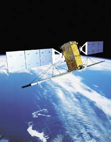 Radarsat 2 satellite
 was the
Canadian Forces’ contribution to the overall security of the
Vancouver 2010 Olympic and Paralympic Games. The maritime security area of responsibility (AOR) covered 1.7 million square kilometres of ocean off Canada’s west coast north to Alaska. During Operation Podium, Canada’s
Radarsat 2 satellite provided wide area maritime surveillance to detect ships in this
AOR. The S-AIS data from
exactEarth was used to identify the vessels detected by Radarsat 2 through
Project Polar Epsilon. By fusing complementary S-AIS data from exactEarth with data from other surveillance systems the Canadian Forces were successful in identifying 95 percent of the vessels detected in the AOR.
exactEarth’s NTS nano-satellite, launched in 2008 for technology validation purposes, continues to orbit the Earth and gather valuable data on global maritime traffic. While not intended for operational monitoring, it has been used in this capacity for two years. exactEarth will begin launching its operational microsatellite constellation this summer.
Topical Tags :
Regional Tags :