
...certified to enter dedicated operational utility evaluation and trial period operations as scheduled in preparation for use by the warfighter. SBIRS delivers global, overhead, persistent, taskable infrared surveillance capabilities to meet 21st-century demands for early warning of missile launches, while simultaneously supporting other critical missions including missile defense, technical intelligence, and battlespace awareness.

Artistic rendition of GEO-1, courtesy of Lockheed Martin
Since its launch in May 2011, GEO-1 and its ground systems have undergone a stringent integrated operational and developmental test campaign in which stressing scenarios were injected to demonstrate the system's readiness to enter dedicated operational utility evaluation and trial period operations. "In our final test event, we ran the system through a gauntlet that compressed nearly 10 years worth of simulated operational use into a high-intensity two month test period," said Lt. Col. Ryan Umstattd, GEO-1 certification lead. "I couldn't be happier with how well the system performed during those stressing scenarios."
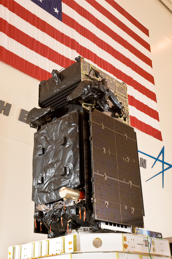
The first SBIRS geosynchronous (GEO-1) spacecraft stands ready to be lowered into its shipping container in preparation for its delivery to Cape Canaveral Air Force Station, Florida, for launch. Photo courtesy of Lockheed Martin.
"SBIRS GEO-1 is performing exceptionally well thus far and we look forward to working shoulder-to-shoulder with the U.S. Air Force and Northrop Grumman to fully certify this critical satellite for operational use," said Steven Blackwell, Lockheed Martin's SBIRS GEO-1 certification lead. "GEO-1, with its highly sophisticated technology, will deliver an unprecedented new infrared surveillance capability for our nation's warfighters."
The SBIRS development team is led by the Infrared Space Systems Directorate at the U.S. Air Force Space and Missile Systems Center, Los Angeles Air Force Base, California. Lockheed Martin Space Systems Company, Sunnyvale, California, is the SBIRS prime contractor, Northrop Grumman Electronic Systems, Azusa, California, is the payload integrator. The 14th Air Force operates the SBIRS system.