
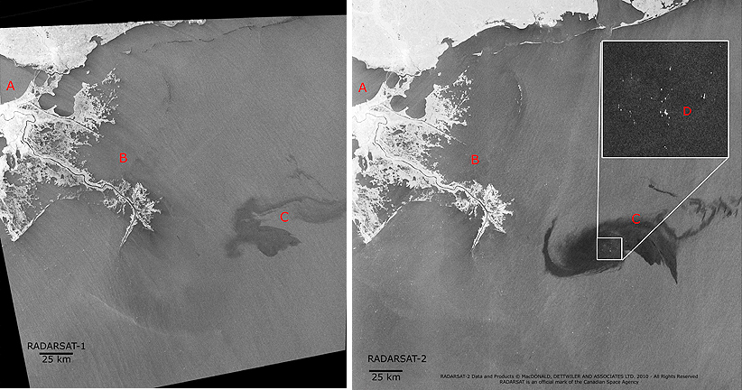
The image on the left was acquired by RADARSAT-1 in ScanSAR Narrow A Beam on April 26, 2010 at 11:59:39 UTC, while the image on the right was acquired by RADARSAT-2 in ScanSAR Narrow B Beam on April 28, 2010 at 11:51:29 UTC. * A) New Orleans, Louisiana * B) Delta of the Mississippi River * C) Oil slick * D) Close-up of ships and equipment
RADARSAT-2 Data and Products are copyright MacDONALD, DETTWILER AND ASSOCIATES LTD, 2010 — All Rights Reserved. RADARSAT is an official mark of the Canadian Space Agency