
[SatNews] Just a day after the disappearance of the aircraft, the very high resolution Pléaides 1A and 1B satellites, the high resolution SPOT 5 and 6 satellites and the synthetic aperture radar satellite TerraSAR-X were programmed to take images of the search zone.
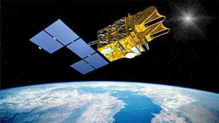
Artistic rendition of Spot 5, satellite imagery for global solutions
© Astrium / D.Apikian
All the data collected has been analyzed by Airbus Defence and Space’s maritime experts and provided to the Malaysian Remote Sensing Agency (MRSA). Additionally, Pléiades images were also supplied via CNES, and TerraSAR-X images via DLR, to the Chinese Meteorological Administration who requested activation of the International Charter Space & Major Disasters on 11 March.
Since Sunday 9 March, Airbus Defence and Space experts have been analyzing the images taken by the optical and radar satellites. Radar satellites such as TerraSAR-X are able to identify layers of hydrocarbon as well as oil slicks or metallic objects floating on the sea. The resolution of the Pléiades 1A & 1B (50 cm after resampling) and SPOT 5 and 6 optical satellites enable identification and characterization of small objects over large surfaces.
The Airbus Defence & Space infosite is located at http://www.astrium.eads.net/