
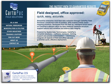
By adding GPS-Photo Link photo-mapping software to the CartoPac Data Interchange (CDI) toolbar, clients can now tie multiple photos of field assets with GPS georeference points. Field workers can view the image on the map display by hovering over a specific GPS point. The hover option allows for quick view of the image and also enables field workers to find all photos in the GIS database related to a specific asset, which increases data efficiency and accuracy for utilities, oil and gas companies, railroad companies and others managing large amounts of geographically dispersed assets. With the new CartoPac Data Interchange: GPS-Photo Link Edition, both office and field personnel can access the photos from the enterprise GIS using a laptop or a handheld device. This new functionality allows customers to set up the configuration and determine the offset between the camera used and the GPS unit, ensuring accurate date and time stamping. Both the CartoPac Data Interchange for ArcGIS toolbar and the GPS-Photo Link extension are designed for easy installation and use. CartoPac offers full support to all field and office workers using CartoPac Data Interchange: GPS-Photo Link Edition.
Satnews Daily
November 21st, 2008
Hovering Is Definitely An Option For CartoPac GPS Field Software
CartoPac Field Solutions has teamed with GeoSpatial Experts to provide software that will make it easier for field workers to download, view and reference GPS points of photos from the enterprise database.
By adding GPS-Photo Link photo-mapping software to the CartoPac Data Interchange (CDI) toolbar, clients can now tie multiple photos of field assets with GPS georeference points. Field workers can view the image on the map display by hovering over a specific GPS point. The hover option allows for quick view of the image and also enables field workers to find all photos in the GIS database related to a specific asset, which increases data efficiency and accuracy for utilities, oil and gas companies, railroad companies and others managing large amounts of geographically dispersed assets. With the new CartoPac Data Interchange: GPS-Photo Link Edition, both office and field personnel can access the photos from the enterprise GIS using a laptop or a handheld device. This new functionality allows customers to set up the configuration and determine the offset between the camera used and the GPS unit, ensuring accurate date and time stamping. Both the CartoPac Data Interchange for ArcGIS toolbar and the GPS-Photo Link extension are designed for easy installation and use. CartoPac offers full support to all field and office workers using CartoPac Data Interchange: GPS-Photo Link Edition.
Select this image for additional information...
By adding GPS-Photo Link photo-mapping software to the CartoPac Data Interchange (CDI) toolbar, clients can now tie multiple photos of field assets with GPS georeference points. Field workers can view the image on the map display by hovering over a specific GPS point. The hover option allows for quick view of the image and also enables field workers to find all photos in the GIS database related to a specific asset, which increases data efficiency and accuracy for utilities, oil and gas companies, railroad companies and others managing large amounts of geographically dispersed assets. With the new CartoPac Data Interchange: GPS-Photo Link Edition, both office and field personnel can access the photos from the enterprise GIS using a laptop or a handheld device. This new functionality allows customers to set up the configuration and determine the offset between the camera used and the GPS unit, ensuring accurate date and time stamping. Both the CartoPac Data Interchange for ArcGIS toolbar and the GPS-Photo Link extension are designed for easy installation and use. CartoPac offers full support to all field and office workers using CartoPac Data Interchange: GPS-Photo Link Edition.