
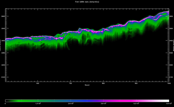
One of CryoSat-2's first synthetic aperture radar data images shows a track across central Antarctica – an area never before charted by satellite. The fine structure in the ice surface, which would be blurred in data acquired by a conventional radar altimeter, is clearly visible. Credits: ESA
Prof. Duncan Wingham, Lead Investigator for the CryoSat mission, said, "The satellite is in very good shape – exceeding in-orbit specifications, the ground segment software is fine, the system of data distribution looks good and we are excited by the quality of data being received. It is extremely rewarding to see the theoretical idea we had for an ice mission 10 years ago now coming to fruition."
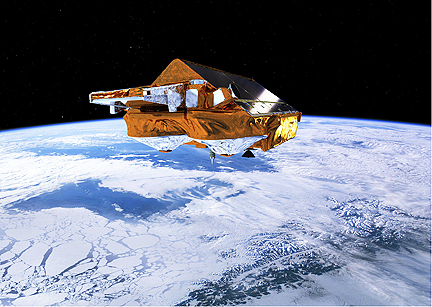
ESA’s Earth Explorer CryoSat mission is dedicated to precise monitoring of the changes in the thickness of marine ice floating in the polar oceans and variations in the thickness of the vast ice sheets that overlay Greenland and Antarctica. Credits: ESA–AOES Medialab
CryoSat is Europe's first mission dedicated to monitoring Earth's ice fields. The satellite carries the first radar altimeter of its kind to overcome the difficulties of measuring icy surfaces. Its primary payload, the sophisticated SAR/Interferometric Radar Altimeter (SIRAL), can measure the thickness of sea ice down to centimetres and monitor changes in the ice sheets on land, particularly around the edges where icebergs are calved from the vast ice sheets that blanket Greenland and Antarctica. Together with information on ice extent, these measurements will show how the volume of Earth's ice is changing and lead to a better understanding of the relationship between ice and climate change.
It was also announced that orbit data from the Doppler Orbit and Radio Positioning Integration by Satellite (DORIS) radio receiver will be released in early July. DORIS is a tracking system carried by CryoSat-2 to detect and measure the Doppler shift on signals broadcast from a network of radio beacons around the world. These signals are used for orbit determination, down to millimetre level and essential for accurately measuring the height of the ice surface. Since the data from DORIS have been validated and shown to be excellent, they are being released to the community before the end of commissioning. Now half-way through commissioning, CryoSat-2 is clearly well on track to delivering the precise data on ice-thickness change that are much-needed to provide a better insight into what is happening to Earth's ice cover as a result of climate change.