
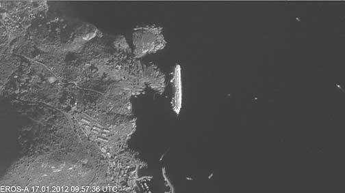
Costa Concordia liner in Tyrrhenian Sea. EROS A image, acquired on January 17 (ImageSat, ScanEx RDC)
Detailed satellite images of the Costa Concordia liner wreck site in Tyrrhenian Sea were acquired. Data from EROS A (resolution – 1.9 m) and EROS B (0.7 m) were received at "UniScan" stations in Russia on January 17 and 20. The images were processed by ScanEx RDC specialists and in near real-time mode delivered to the EMERCOM of Russia.
EROS B image, acquired on January 20, clearly illustrate floating booms. Satellite monitoring of the Costa Concordia wreck site will be continued.
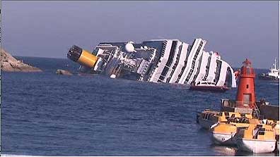
Costa Concordia liner hit the rocks on January 13 января near Toscana coast and ran aground. Photo: RIA Novosti