[SatNews] The IGNIS innovation project, spearheaded by Spanish satellite telecommunications operator HISPASAT, has concluded with a final demonstration combining satellite communications with a range of services and technologies at the scene of a forest fire.

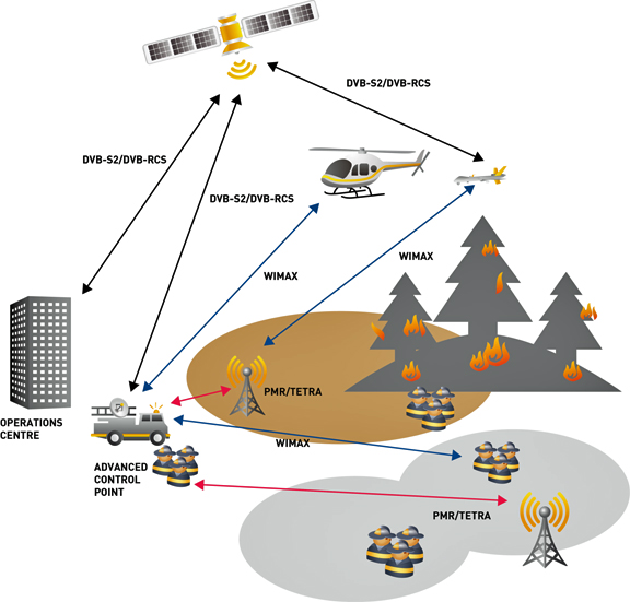
With the developments of this project, fire fighters can obtain more reliable data in real time to help them put out fires more efficiently and safely. To achieve these results, IGNIS’ final demonstration was backed by the HISPASAT’s robust satellite communications, which transmitted real-time information on the location and video images of the fire captured by the UAV to the operations through a communication network that combines satellite and WIMAX. IGNIS provides greater accuracy on the development and spread of fires, helping to prevent fire fighters from taking any unnecessary risks.
The project stems from the findings of another R&D project that also involved HISPASAT, Prometeo, that analyzed the parameters and processes of satellite remote sensing data, as well as new telecommunication technologies and architectures for night-time forest fire extinction. IGNIS furthers the research begun with Prometeo by developing, in a short period of time, a system that improves on the current telecommunications infrastructures used to combat forest fires.
HISPASAT participates actively in a number of Spanish and international projects, such as IGNIS, for the development of new technologies and the definition of new satellite communications network architectures that offer customers value-added solutions and support new quality services. In addition to HISPASAT, IGNIS also involved a number of industry companies and organisations, such as INAER, Albentia, ISDEFE, the Centre for Advanced Aerospace Technologies (FADA-CATEC), the Technical University of Madrid (UPM) and TECNALIA.
The HISPASAT infosite may be visited at http://www.hispasat.es/

