
NigeriaSat-1's imagery is very valuable and effective for mapping changes in land use such as mapping city growth, predicting crop yields and water resource monitoring. The satellite is currently providing regular images in order to map the spread of desertification in West Africa. In separate campaigns it is also being used to map the course of the river Niger and contributing to land use mapping in South Africa. Once the satellite has been told where to take the images ("tasked") using a computer based planning system called an MPS, the images are downloaded from the satellite and processed to turn them into useful information. To date, the Nigerian trainees have also honed their skills response to the International Charter: Space and Major Disasters, which is a global effort to coordinate satellite imaging of natural disasters from space including flooding and wild fires. An important part of the technical training is to learn about image processing techniques that remove distortion from data, and orthorectification — the process of lining up the image data with geographical navigation information so it can used to make maps for governments and relief agencies.
Satnews Daily
April 23rd, 2009
African Resource Mapping Being Taught To Nigerian Engineers
Nigeria will soon be able to map and monitor African resources with local expertise.
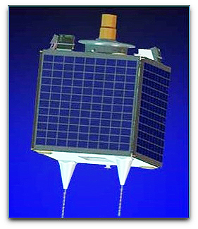 Nigeria's first satellite imaging engineers are receiving hands-on training at DMCii in Guildford, U.K., to manage and process the images NigeriaSat-1 and the future NigeriaSat-2 and NX satellites will capture upon their return to their country. Now in training, Oludare Mabogunje and Kennedy Uti will play a crucial
part in Nigeria's future space program, developing African satellite imaging capability for monitoring desertification, land use, water resources and international disasters. The training and development program with DMCii complements the training of Nigerian engineers within parent company SSTL that is reinforcing Nigeria's space program with fully qualified native talent. Oludare and Kennedy balance their weeks between lectures at the nearby University of Surrey, coursework and hands-on satellite image processing at DMCii as part of an intensive 16 month training program.
Nigeria's first satellite imaging engineers are receiving hands-on training at DMCii in Guildford, U.K., to manage and process the images NigeriaSat-1 and the future NigeriaSat-2 and NX satellites will capture upon their return to their country. Now in training, Oludare Mabogunje and Kennedy Uti will play a crucial
part in Nigeria's future space program, developing African satellite imaging capability for monitoring desertification, land use, water resources and international disasters. The training and development program with DMCii complements the training of Nigerian engineers within parent company SSTL that is reinforcing Nigeria's space program with fully qualified native talent. Oludare and Kennedy balance their weeks between lectures at the nearby University of Surrey, coursework and hands-on satellite image processing at DMCii as part of an intensive 16 month training program.
NigeriaSat-1's imagery is very valuable and effective for mapping changes in land use such as mapping city growth, predicting crop yields and water resource monitoring. The satellite is currently providing regular images in order to map the spread of desertification in West Africa. In separate campaigns it is also being used to map the course of the river Niger and contributing to land use mapping in South Africa. Once the satellite has been told where to take the images ("tasked") using a computer based planning system called an MPS, the images are downloaded from the satellite and processed to turn them into useful information. To date, the Nigerian trainees have also honed their skills response to the International Charter: Space and Major Disasters, which is a global effort to coordinate satellite imaging of natural disasters from space including flooding and wild fires. An important part of the technical training is to learn about image processing techniques that remove distortion from data, and orthorectification — the process of lining up the image data with geographical navigation information so it can used to make maps for governments and relief agencies.
NigeriaSat-1's imagery is very valuable and effective for mapping changes in land use such as mapping city growth, predicting crop yields and water resource monitoring. The satellite is currently providing regular images in order to map the spread of desertification in West Africa. In separate campaigns it is also being used to map the course of the river Niger and contributing to land use mapping in South Africa. Once the satellite has been told where to take the images ("tasked") using a computer based planning system called an MPS, the images are downloaded from the satellite and processed to turn them into useful information. To date, the Nigerian trainees have also honed their skills response to the International Charter: Space and Major Disasters, which is a global effort to coordinate satellite imaging of natural disasters from space including flooding and wild fires. An important part of the technical training is to learn about image processing techniques that remove distortion from data, and orthorectification — the process of lining up the image data with geographical navigation information so it can used to make maps for governments and relief agencies.