[SatNews] Cloud cover has always been a problem for companies that rely on satellite or aerial imagery in tropical locations...
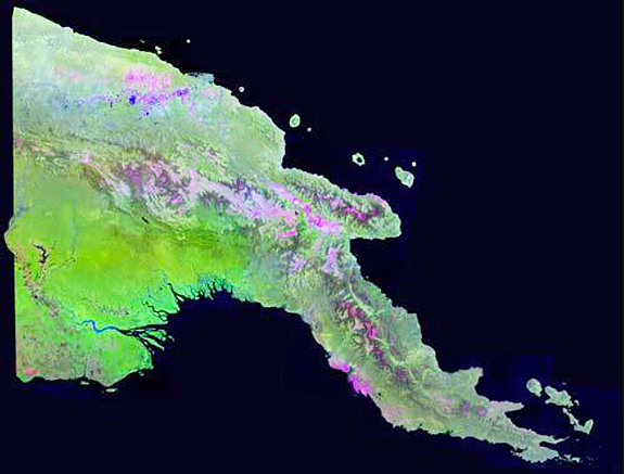
Such is certainly true for Papua New Guinea, where the ground is obscured for up to 90 percent% of the year. With this in mind, Geoimage has created the first low cloud Landsat image mosaic of Papua New Guinea to aid numerous industries with their mapping needs. Created using multiple scenes from the Landsat satellites, the new ClearView™– PNG product has taken the cloud element out of the imagery to reveal what lies below and allow consistent mapping at 1:50,000 scale across the entirecountry.
Remotely-sensed satellite images of large areas provide a bird's eye view of the landscape, which supports a range of activities essential for industry operations. Satellite imagery, digital surface models and supplementary spatial datasets can all assist the planning for and construction of vital infrastructure. The team at Geoimage have extensive experience in providing core spatial datasets including satellite imagery for mapping land cover plus feature extraction of infrastructure and other terrestrial or marine based characteristics. Digital surface models are used to understand topographic variability, site suitability or routing of infrastructure and are especially vital in comprehending costs associated with slope, topographic variability or elevation. Geoimage also provides advice on when very high resolution data is required and when alternatives can be deployed to save time, costs and processing requirements. The ClearView mosaic is the Company's most recent product and is used up by those wishing for clarity for their PNG operations.