
NASA image courtesy Jeff Schmaltz, LANCE/EOSDIS MODIS Rapid Response Team at NASA GSFC. Caption by Holli Riebeek.
Instrument: Terra - MODIS.
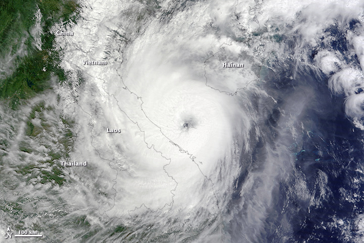
The Moderate Resolution Imaging Spectroradiometer (MODIS) on NASA’s Terra satellite acquired this image of the storm at 10:35 a.m. local time (3:35 UTC), several hours before landfall. At the time, Wutip was a Category 2 storm with winds of 90 knots (170 km/hr or 100 miles/hr). It weakened before landfall.
According to new reports, Wutip left 75 Chinese fishermen missing and caused flooding and structural damage in Vietnam. It is expected to move west over Laos and Thailand, where it could compound ongoing flooding.