
 [SatNews] The PlanetObserver team has released PlanetDEM 30, a new Digital Elevation Model (DEM) covering...
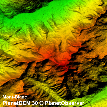
...the entire Earth at 30m resolution, offering accurate, homogeneous and voidfree data. PlanetDEM 30 is a fusion of 30m ASTER Global DEM v2.0 and PlanetDEM 90, PlanetObserver high quality 90m global DEM product. PlanetObserver developed exclusive data fusion processes that are based on proprietary technology. PlanetDEM 30 is a 100 percent global product, totally free of ASTER GDEM residual anomalies and artifacts that, in the past, affected overall data quality.
Based on the combination of 90m SRTM (Shuttle Radar Topography Mission) data v4.1 corrected and completed with cartographic data, this highly accurate product has already been acquired by major players within the spatial and defence industry. PlanetDEM 30's overall accuracy is a major asset for all applications, even those that are the most sensitive in nature. This worldwide 3D reference dataset is ideal for defence, orthorectification, mapping, weather systems, terrain modelling applications, energy exploration and geology, to name but a few sectors.