
Following the eruption, scientists and local authorities have been using a long series of space images from ESA’s Envisat, together with seismic and helicopter data, to monitor the situation and calm fears of the local population. Dr. Nicolas d’Oreye of GORISK, which is in Congo assisting the Goma Volcano Observatory to collect and process satellite observations and field data, said the satellite images are very useful for managing the crisis. "As well as helping to validate information from different datasets, the satellite images are providing invaluable information about the situation, such as the details about the lava flow and the fact that the Nyiragongo volcano is not showing any signs of abnormal activity. This has been of great importance for the local authorities and the Goma Volcano Observatory, who are holding daily crisis meetings, to reassure the local population and humanitarian agencies that Nyiragongo will be unaffected by the eruption of Nyamulagira."
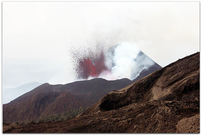
Mount Nyamulagira lava flows
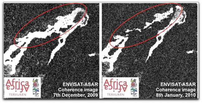
Lava flows can be mapped by comparing satellite radar images acquired before and after the eruption. In the images, old lava appears bright white. If an area appears white in before images and black in after images, then the ground has changed between acquisitions by the flow of new lava. By comparing images acquired over the area before and after the eruption by the Advanced Synthetic Aperture Radar (ASAR) on Envisat, the GORISK team was able to detect a lava flow in the main caldera and one of the paths of the flows.