
DigitalGlobe has just released two satellite images depicting the devastating effects of Hurricane Irene in Vermont. The first image shows the town of Killington on August 29, 2011; you can see that high creek waters have washed away the pavement on the road. The second image shows the Killington Ski Resort and presents a stark contrast between the beautiful foliage and the many areas where the earth has given away in a mud slide. All photos are courtesy of DigitalGlobe.
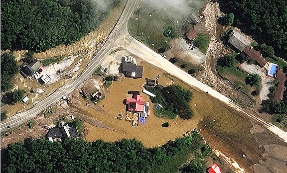
Hurricane Irene Damage, Killington , Vermont-August 29, 2011: This is a satellite image of severe damage in Vermont in the town of Killington along US Hwy 4 and Road 100. Of note is the washout/slide in the upper right between the houses which covers the road. In the center, the pavement that has been washed away by high creek waters. The center of the image has several businesses surrounded by mud and water.
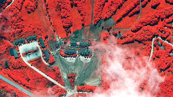
Killington Ski Lodge, Vermont-August 29, 2011: This is a satellite image of damage at the Killington Ski Lodge in Vermont. The bright red vegetation is healthy and the grey areas are where earth has given way in a mud slide around the resort and parking lots. (credit: DigitalGlobe)