[SatNews] There are new apps available for the iPad and iPhone that allow the user to work with interactive navigational charts.
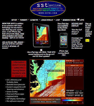
SST Online, LLC (SSTOL) has been providing offshore sea surface temperature, turbidity and altimetry data to recreational and commercial fisherman and other outdoor enthusiasts for more than 15 years. Recently, SSTOL announced new apps for the iPad and iPhone which allow users to download daily updates via a wi-fi or 3G connection and use that data in its interactive charting products. More importantly, those users with GPS-enabled devices, such as the iPad 3G and iPhone4, will be able to track their position on SSTOL's proprietary interactive navigational charts in real time, so they will know exactly where they are and where they need to be to encounter favorable conditions and catch more fish. Sea surface temperature charting shows the position and movement of the Gulf Stream and other currents important to offshore fisherman. Turbidity data shows the clarity of the water and altimetry data shows the upwellings and downwellings at the ocean's surface that cause macro ocean currents and cause nutrient-rich waters to rise from the bottom, bringing with it plankton, bait fish and the pelagic fish targeted by fisherman. SSTOL currently covers the U.S. East Coast, Florida Gulf Coast, the Florida Keys and the Bahamas, with other coastal areas to be added. Its interactive charting takes advantage of the iPad and iPhone4's high resolution display and user interface by providing high definition data and tap screen functionality including waypoint placement, distance and bearing functions as well as GPS coordinates and water temperature data. The iPad app is currently available in the iTunes App store and the iPhone App will be available by March 15th.