
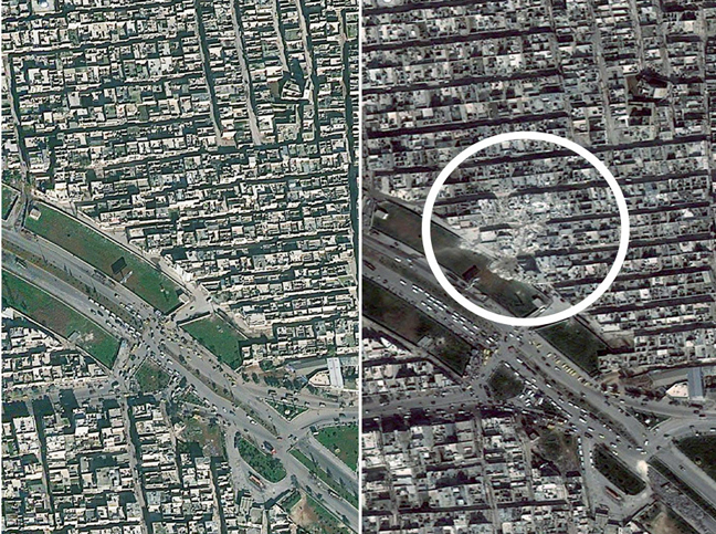
Satellite images show the Jabal Badro area of Aleppo, Syria before, left, and after, right, a ballistic missile strike on the evening of 18 February 2013 which reportedly killed scores of residents. Amnesty claim Syrian government forces have relentlessly and indiscriminately bombarded areas under the control of opposition forces across Syria, with civilians being at the receiving end of such attacks and at the same time also being subjected to abuses by some armed opposition groups.
Image courtesy of Digital Globe via Amnesty International.
Working with the American Association for the Advancement of Science, the organization analyzed satellite images captured over the past year of Aleppo, Syria’s largest city and the site of a long-running battle between the government and rebel forces. The study found hundreds of damaged or destroyed buildings, disproportionately in opposition-held neighborhoods, and a proliferation of roadblocks, with more than 1,000 visible in imagery from late May.
Earlier satellite projects focused on the Syrian cities of Homs and Hama and on documenting the growth of makeshift camps of displaced people near the Turkish border.
Satellite imagery allows the organization to gather critical data quickly and without putting witnesses or researchers in danger, said Scott Edwards, project manager for Amnesty’s Science for Human Rights project. He says the organization will continue to use multiple channels to collect information about abuses.
Satellite imagery of Syria shows damaged or destroyed buildings and a growing number of roadblocks and camps for displaced people.
“In many ways, Syria has become one very large crime scene,” he says. “Actors on the ground should be aware that there are satellites overhead and a wealth of video evidence emanating out of the country.”