
...international Conference Earth from Space — the Most Effective Solutions, which, for the sixth time, will be held from October 1-3, 2013 in the "Vatutinki" resort hotel, Moscow Region.

Key topics of the conference will be: The protection of nature and the access to space imagery and near real-time satellite-based monitoring services from Russia and abroad. Conference organizers are: ScanEx Research & Development Center and NGO Transparent World. Conference participation requests may be placed by completing the registration form at conference.scanex.ru.
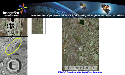
ImageSat is the company operating the EROS A (launched in 2000, spatial resolution of 1.9m) and EROS B (2006, 0.7m) satellites. Currently submeter resolution data received from RS satellites help to serve a wide range of civil sector applications...
 For example, optical satellite images served as the source of operational data concerning the ice flow situation during the escort of the Yuri Arshenevsky motor ship, loaded with cargo for Sabetta transpolar port construction on the Yamal peninsular in the spring of 2013. ScanEx specialists, armed with archived and new images acquired from the EROS B satellite, also conducted monitoring of the Big Sochi Olympics construction activities. EROS A/B images were used by the specialists of the center for monitoring ice and water areas in the Russian Arctic regions, for monitoring forest cuttings in Khibiny mountains. With the help of very high resolution EROS A/B imagery data, "hot spots" sources were detected where tail petroleum gas is being burned.
About 10 UniScan ground receiving stations have already been installed in Russia, ensuring the reception and processing of data acquired from EROS series satellites. An operational data tasking system has been established which enables prompt information reception. ScanEx RDC is the Operator of the UniScan stations network on the territory of Russia for reception of EROS A/B satellite data.
During the upcoming conference, ImageSat company specialists will present the results of projects that monitor various sites and phenomena with the help of the highly-detailed imagery from EROS A/B satellites.