Ball Aerospace... PERfect Prep (Satellite)
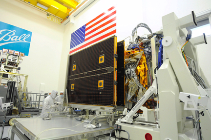
[SatNews] The fully-integrated NPOESS Preparatory Project (NPP) weather satellite has successfully completed its Pre-Environmental Review (PER) on-schedule in advance of flight environmental testing at Ball Aerospace & Technologies.
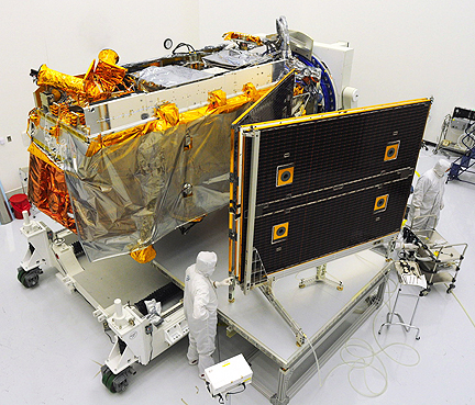 Ball Aerospace technicians perform a "pop-and-catch" partial deploy of the NPOESS Preparatory Project weather satellite's solar array during this week's successful Pre-Environmental Review. NPP is scheduled to launch in October 2011.
The launch is slated for October 2011, with a mission duration of five years. The last of five instruments to fly aboard the polar-orbiting satellite was successfully integrated in July. The pre-environmental review of the flight satellite configuration with the full suite of instruments was conducted last week at
Ball’s Boulder production and test facility by a group of multi-disciplinary experts from
NASA and
NOAA, as well as a number of independent reviewers. Environmental testing includes vibration, acoustics, shock, electromagnetic interference and compatibility and thermal vacuum. The five-instrument suite includes: the
Visible/Infrared Imager Radiometer Suite (
VIIRS); the
Cross-track Infrared Sounder (
CrIS); the
Clouds and the Earth Radiant Energy System (
CERES); the
Advanced Technology Microwave Sounder (
ATMS); and the
Ozone Mapping and Profiler Suite (
OMPS).
 Ball Aerospace
 built the OMPS instrument, and also built the NPP spacecraft under contract to NASA’s
Goddard Space Flight Center. The
Ball Commercial Platform (
BCP)
2000 was modified to successfully accommodate all five of the NPP instruments. Ball Aerospace recently announced that it was awarded a sole source contract from NASA for a second Ozone Mapping and Profiling Suite (OMPS) instrument to fly on the
Joint Polar Satellite System (
JPSS). JPSS is scheduled to launch in 2014. NPP’s advanced visible, infrared, and microwave imagers and sounders will improve the accuracy and timeliness of climate observations and enhance capabilities to the nation’s civil and military users of satellite data.
Topical Tags :
Regional Tags :
